IMAGES TAKEN NEAR TO
Malling, LEWES, BN7 2DY
Introduction
This page details the photographs taken nearby to Malling, BN7 2DY by members of the Geograph project.
The Geograph project started in 2005 with the aim of publishing, organising and preserving representative images for every square kilometre of Great Britain, Ireland and the Isle of Man.

There are currently over 7.5m images from over14,400 individuals and you can help contribute to the project by visiting https://www.geograph.org.uk
Image Map
Images are licensed for reuse under creativecommons.org/licenses/by-sa/2.0
Notes
- Clicking on the map will re-center to the selected point.
- The higher the marker number, the further away the image location is from the centre of the postcode.
Image Listing (37 Images Found)
Images are licensed for reuse under creativecommons.org/licenses/by-sa/2.0
Image
Details
Distance
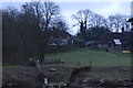
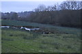
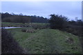
4
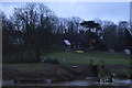
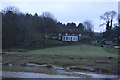
Old Malling Farm
Once the site of Malling College which existed from 1150 until its dissolution in 1547, part of a wall still exists in one of the cottages on the farm site. Viewed from the western bank of the River Ouse.
Image: © Simon Carey
Taken: 29 Dec 2008
0.06 miles
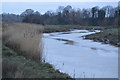
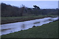
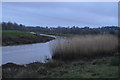
7
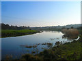
River Ouse
Looking back downstream towards Lewes, the tower belongs to the church of St John sub Castro, Lewes Castle is slightly obscured by foliage to the right.
Image: © Simon Carey
Taken: 29 Dec 2008
0.12 miles