
IMAGES TAKEN NEAR TO
Furzeland Way, HASSOCKS, BN6 9JB
Introduction
This page details the photographs taken nearby to Furzeland Way, BN6 9JB by members of the Geograph project.
The Geograph project started in 2005 with the aim of publishing, organising and preserving representative images for every square kilometre of Great Britain, Ireland and the Isle of Man.

There are currently over 7.5m images from over14,400 individuals and you can help contribute to the project by visiting https://www.geograph.org.uk
Image Map
Images are licensed for reuse under creativecommons.org/licenses/by-sa/2.0
Notes
- Clicking on the map will re-center to the selected point.
- The higher the marker number, the further away the image location is from the centre of the postcode.
Image Listing (54 Images Found)
Images are licensed for reuse under creativecommons.org/licenses/by-sa/2.0
Image
Details
Distance
1
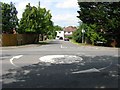
Furzeland Way, Sayers Common
Viewed from its junction with London Road, the former A23. The cul de sac was built in the 1930s.
Image: © Simon Carey
Taken: 31 Jul 2014
0.03 miles
2
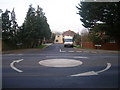
Furzeland Way
Small postwar cul-de-sac in the village of Sayers Common for many years those living in this road would have to try and join the main A23 as it went through the village. Since the 1990s, London Road has been downgraded to the B2118 and it is far easier to leave this road.
Image: © Simon Carey
Taken: 4 Jan 2009
0.03 miles
3
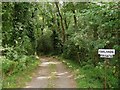
Drive to Oaklands, Sayers Common
Viewed from the junction with london Road, the house is located within Sayers Common Wood.
Image: © Simon Carey
Taken: 31 Jul 2014
0.04 miles
4
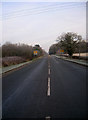
London Road
The B2118 formerly the A23 downgraded when the new dual carriageway was constructed in the early 1990s. Originally the road formed one of many turnpikes linking London-Brighton and only really became the route of choice in the 1820s.
Image: © Simon Carey
Taken: 4 Jan 2009
0.06 miles
5
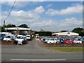
Old Forge Garage, London Road, Sayers Common
The former smithy actually lay out of shot to the right opposite Image and survived until just after the First World War, whereupon a filling station was built on this site which served motorists on the old A23 until the 1970s whereupon it became a garage and later a car sales showroom.
Image: © Simon Carey
Taken: 31 Jul 2014
0.07 miles
6
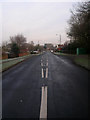
London Road
Entering Sayers Common from the south. This former turnpike was one of many that ran between London-Brighton and only became the favoured route from the 1820s onwards. It remained the main road to London until the early 1990s when the entire A23 was dualled from Pease Pottage to the A27, the road was widened in places and bypassed the villages of Sayers Common and Albourne. Today it is the B2118.
Image: © Simon Carey
Taken: 4 Jan 2009
0.07 miles
7
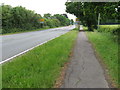
Approach to Sayers Common
The B2118 was the former A23 trunk road.
Image: © Dave Spicer
Taken: 6 Jun 2010
0.07 miles
8
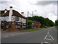
Duke of York Inn, Sayers Common
The road in front is the former A23 now bypassing this village to the east.
Image: © Simon Carey
Taken: 26 Aug 2006
0.08 miles
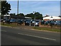
10
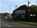
Duke of York public house, Sayers Common
Image: © Stacey Harris
Taken: 25 Sep 2011
0.09 miles