IMAGES TAKEN NEAR TO
Cuckfield Road, HASSOCKS, BN6 9GL
Introduction
This page details the photographs taken nearby to Cuckfield Road, BN6 9GL by members of the Geograph project.
The Geograph project started in 2005 with the aim of publishing, organising and preserving representative images for every square kilometre of Great Britain, Ireland and the Isle of Man.

There are currently over 7.5m images from over14,400 individuals and you can help contribute to the project by visiting https://www.geograph.org.uk
Image Map (Loading...)


Getting Data...Please wait
Leaflet Map data © OpenStreetMap
Images are licensed for reuse under creativecommons.org/licenses/by-sa/2.0
Notes
- Clicking on the map will re-center to the selected point.
- The higher the marker number, the further away the image location is from the centre of the postcode.
Image Listing (36 Images Found)
Images are licensed for reuse under creativecommons.org/licenses/by-sa/2.0
Image
Details
Distance
1
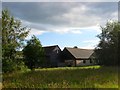
Barns, Danworth Farm
Now converted into small business units.
Image: © Simon Carey
Taken: 6 Jul 2014
0.01 miles
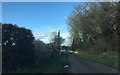
3
Danworth Farm
Viewed from Danworth Lane.
Image: © Chris Thomas-Atkin
Taken: 7 May 2020
0.03 miles
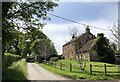
4
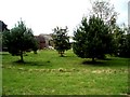
Danworth Farm House, Danworth Lane
A 19th century farmhouse on a ridge above Herrings Stream. The houses visible through the trees in the distance are Image
Image: © Simon Carey
Taken: 6 Jul 2014
0.04 miles
5
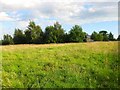
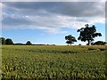
Hay Barn Field (1)
The name of the field according to Hurstpierpoint's 1842 tithe map that has now been split into two separate fields. This part lies to the immediate west of Danworth Farm whilst the other lies further to the west beyond a new hedge, see Image
Image: © Simon Carey
Taken: 6 Jul 2014
0.04 miles
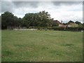
7
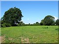
Acre Plot
The name of the field according to Hurstpierpoint's 1842 tithe map that is bounded to the south and west by Image and to the east by Danworth Lane.
Image: © Simon Carey
Taken: 7 Aug 2014
0.06 miles
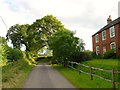
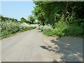
8
Danworth Lane
Danworth Lane close to Danworth Brook Farm.
Image: © Chris Thomas-Atkin
Taken: 15 Mar 2018
0.06 miles
10
Hay Barn Field (2)
The name of the field according to Hurstpierpoint's 1842 tithe map that has now been split into two. This section now includes Image to the west though the former hedgerow trees remain in place. Beyond a newer hedge out of shot to the left is the other part of the field, see Image
Image: © Simon Carey
Taken: 6 Jul 2014
0.07 miles