
IMAGES TAKEN NEAR TO
Talbot Mead, HASSOCKS, BN6 9FN
Introduction
This page details the photographs taken nearby to Talbot Mead, BN6 9FN by members of the Geograph project.
The Geograph project started in 2005 with the aim of publishing, organising and preserving representative images for every square kilometre of Great Britain, Ireland and the Isle of Man.

There are currently over 7.5m images from over14,400 individuals and you can help contribute to the project by visiting https://www.geograph.org.uk
Image Map
Images are licensed for reuse under creativecommons.org/licenses/by-sa/2.0
Notes
- Clicking on the map will re-center to the selected point.
- The higher the marker number, the further away the image location is from the centre of the postcode.
Image Listing (29 Images Found)
Images are licensed for reuse under creativecommons.org/licenses/by-sa/2.0
Image
Details
Distance
1
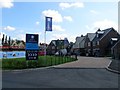
Chalkers Vale, Hurstpierpoint
A new development of 38 dwellings in a triangular piece of land bounded in the north by a small stream, and Cuckfield Road and Chalkers Lane to the west and east respectively. The development has not gone to plan as 15 new houses had to be demolished after it was discovered substandard concrete had been used in the foundations.
Image: © Simon Carey
Taken: 7 Aug 2014
0.02 miles
3
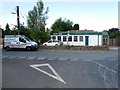
White Eagle Foundry Ltd, Cuckfield Road, Hurstpierpoint
A small foundry located at the northern end of the village opposite the junction with Chalkers Lane next door to Image
Image: © Simon Carey
Taken: 7 Aug 2014
0.08 miles
4
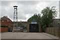
Hurstpierpoint fire station
Hurstpierpoint fire station, Cuckfield Road, Hurstpierpoint, West Sussex
Image: © Kevin Hale
Taken: 16 Jun 2007
0.09 miles
5
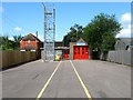
Hurstpierpoint Fire Station, Cuckfield Road, Hurstpierpoint
Located next to Image and replaced an older station on the High Street.
Image: © Simon Carey
Taken: 7 Aug 2014
0.10 miles
6
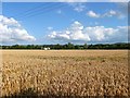
Ten Acres
The name of the field according to Hurstpierpoint's 1842 tithe map that has been merged with Image to the north east to form a larger single unit. The current field is bounded by Image to the north, Cuckfield Road to the west and chalkers lane to the east, the latter marked by the pair of cottages called Cobb's Croft.
Image: © Simon Carey
Taken: 13 Jul 2014
0.10 miles
7
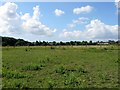
Pond Field
The name of the field according to Hurstpierpoint's 1842 tithe map that lies to the north of Image The wood on the left is Tilley's Copse whilst the houses on the right front onto Cuckfield Road. You get the sense that sometime in the future this field will become another housing estate.
Image: © Simon Carey
Taken: 7 Aug 2014
0.11 miles
8
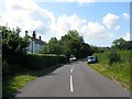
Cobbs Croft, Chalkers Lane
A pair of 19th century cottages, they are mentioned on Hurstpierpoint's 1842 tithe map, a little to the north of the village edge.
Image: © Simon Carey
Taken: 7 Aug 2014
0.12 miles
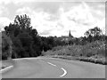
10
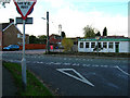
Cuckfield Road, Hurstpierpoint
Looking west from the junction with Chalkers Lane. The Fire Station tower is in the centre of the picture.
Image: © Simon Carey
Taken: 5 Nov 2005
0.12 miles