
IMAGES TAKEN NEAR TO
North End, HASSOCKS, BN6 8TD
Introduction
This page details the photographs taken nearby to North End, BN6 8TD by members of the Geograph project.
The Geograph project started in 2005 with the aim of publishing, organising and preserving representative images for every square kilometre of Great Britain, Ireland and the Isle of Man.

There are currently over 7.5m images from over14,400 individuals and you can help contribute to the project by visiting https://www.geograph.org.uk
Image Map
Images are licensed for reuse under creativecommons.org/licenses/by-sa/2.0
Notes
- Clicking on the map will re-center to the selected point.
- The higher the marker number, the further away the image location is from the centre of the postcode.
Image Listing (232 Images Found)
Images are licensed for reuse under creativecommons.org/licenses/by-sa/2.0
Image
Details
Distance
1

Northgate, North End
As the name suggests the location of the former tollgate that allowed access in and out of Ditchling. On the left is one of three chicanes built in the 1990s to calm traffic entering the village from the north on the B2112.
Image: © Simon Carey
Taken: 16 Aug 2009
0.01 miles
2

The North Star, North End
A former public house on the B2112 as it heads north out of the village. It closed a number of years ago and is now a private residence.
Image: © Simon Carey
Taken: 16 Aug 2009
0.01 miles

4

Public footpath, Ditchling
This public footpath leads northwards from the village of Ditchling in the South Downs National Park.
Image: © Malc McDonald
Taken: 26 May 2013
0.05 miles
5

North End
The name of the B2112 as it heads north out of Ditchling.
Image: © Simon Carey
Taken: 16 Aug 2009
0.05 miles
6

Ditchling: The church of St. Margaret of Antioch: The Poole monument coat of arms 3
Image: © Michael Garlick
Taken: 19 Jan 2016
0.06 miles
7

High Street, Ditchling, East Sussex
View taken looking S down the High Street of this small village. The S Downs are visible in the background. The flags were out because this was the day that the Tour de France came to town.
Image: © Pete Chapman
Taken: 6 Jul 1994
0.07 miles
8

The Sussex Border Path leaving the High Street and turning into East Gardens
Image: © Dave Spicer
Taken: 6 Feb 2010
0.09 miles
10
Harrys
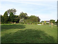
The name of the field according to the 1843 tithe map and a meeting point for four footpaths which exit at all corners of the field.
Image: © Simon Carey
Taken: 19 Aug 2009
0.10 miles