IMAGES TAKEN NEAR TO
Mill End, HENFIELD, BN5 9UN

Introduction

This page details the photographs taken nearby to Mill End, BN5 9UN by members of the Geograph project.

The Geograph project started in 2005 with the aim of publishing, organising and preserving representative images for every square kilometre of Great Britain, Ireland and the Isle of Man.

There are currently over 7.5m images from over14,400 individuals and you can help contribute to the project by visiting https://www.geograph.org.uk

Image Map


Images are licensed for reuse under creativecommons.org/licenses/by-sa/2.0
Notes
  • Clicking on the map will re-center to the selected point.
  • The higher the marker number, the further away the image location is from the centre of the postcode.

Image Listing (204 Images Found)

Images are licensed for reuse under creativecommons.org/licenses/by-sa/2.0
  • ...
Image
Details
Distance
1
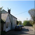
The Forge/1-2 Mill End Cottage, Mill End, Nep Town, Henfield
All buildings appear to date from the 19th century with the building on the left once having been a forge that was converted into light industrial use. The planning page for the building also notes that it has been used as a shop and the last application in 2014 was to convert it into a residence. Nep Town Road becomes Mill End at the junction with Broomfield Road before turning into Dropping Holms at the junction with Sandy Lane. The short section of road contains these buildings and neighbouring Image
Image: © Simon Carey Taken: 9 Apr 2017
0.00 miles
2
House on Nep Town Road
Image: © Ian Hawfinch Taken: 5 Sep 2021
0.01 miles
3
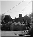
Wistaria Cottage, Mill End, Nep Town, Henfield
Located to the immediate east of Image and also built in the 17th century. The spelling is that taken from the name plate outside the house. Beyond is Image
Image: © Simon Carey Taken: 9 Apr 2017
0.01 miles
4
Houses on Mill End
Image: © Ian Hawfinch Taken: 9 Nov 2020
0.01 miles
5
Rosemount, Windmill Lane, Nep Town, Henfield
An 18th century building located at the junction with Mill End.
Image: © Simon Carey Taken: 10 Jun 2017
0.02 miles
6
Old Mill House, Sandy Lane, Nep Town, Henfield
Located at the junction with Mill End and Dropping Holms and built in the early 17th century. Neptown Windmill was located on Mill Hill to the south of the house and was in operation from 1724 until the late 19th century. The mill blew down in a storm in 1908. See http://www.sussexmillsgroup.org.uk/images/neptown1900.jpg for the only known photograph of the windmill taken around 1900.
Image: © Simon Carey Taken: 9 Apr 2017
0.02 miles
7
Henfield, Sussex - rear view of houses on Broomfield Road
Storm Ciara (yesterday) has caused one of these fence panels to come adrift.
Image: © Ian Hawfinch Taken: 10 Feb 2020
0.03 miles
8
Nep Town Road - view west towards Mill End
Image: © Ian Hawfinch Taken: 1 May 2021
0.03 miles
9
Highcroft Villas, Windmill Lane, Nep Town, Henfield
Built in the last third of the 19th century on the eastern side of the lane.
Image: © Simon Carey Taken: 10 Jun 2017
0.04 miles
10
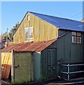
Henfield, Sussex - the Tin Chapel
Image: © Ian Hawfinch Taken: 11 Jan 2014
0.04 miles
  • ...