1
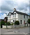
Downsview Terrace, Staples Barn Lane, Henfield
Built between the wars and predating much of the development of Staples Barn Lane. The barn itself was once located at the end of the terrace.
Image: © Simon Carey
Taken: 1 Jun 2017
0.01 miles
2
Staples Barn Lane, Henfield
The northern end of the residential road prior to it becoming Staples Barn which then continues eastwards to Fabians Way. This was the site of Staples Barn which still stood on a 1946 aerial photograph but had disappeared by the time of a 1956 edition of the OS map replaced by a set of garages. This have since been removed and replaced by the current houses initially called Barn Cottages a name retained by those on the right but not those to the left which are now known by their individual house names.
Image: © Simon Carey
Taken: 9 Jul 2017
0.03 miles
3
26-28, Staples Barn, Henfield
A small block of flats that are part of the Staples Barn estate built sometime in the 1960s.
Image: © Simon Carey
Taken: 9 Jul 2017
0.04 miles
4
The "Cat & Canary" PH in Henfield
There is a story that the vicar of Henfield's cat ("Tom") ate a neighbour's canary ("Tweetie-Pie"). Effigies of both creatures are at the "Cat House" in the village. See http://www.geograph.org.uk/photo/1541020 for a better view of the sign at the PH. The PH has been known as the "Old Railway Tavern" and the "Station Hotel" in the past.
Image: © Shazz
Taken: 17 Oct 2009
0.06 miles
5
View north on the Downs Link at Henfield
The picture was taken from the public car park next to the "Cat and Canary" PH.
Image: © Shazz
Taken: 17 Oct 2009
0.06 miles
6
The Cat and Canary
Public House on the Downs Link long distance route.
Image: © Paul E Smith
Taken: 9 May 2010
0.06 miles
7
The sign at the "Cat & Canary" PH in Henfield
The Public House is beside the Downs Link which is a walk on a dismantled railway line. Until recently the PH was called the "Station Hotel".
Image: © Shazz
Taken: 17 Oct 2009
0.06 miles
8
Flora Villas, Upper Station Road, Henfield
Located on the corner of Staples Barn Lane and built in the 1860s taking advantage of the recently opened Henfield station nearby.
Image: © Simon Carey
Taken: 14 May 2017
0.07 miles
9
Adensfield, Upper Station Road, Henfield
The current building dates from the early 1970s and was built as the village's Police Station to replace an older one that had been constructed in the late 19th century. Not certain when the police moved out as I have a reference for it being still open in 1986 and an entry in the local planning site for an extension to a private dwelling in 2004.
Image: © Simon Carey
Taken: 9 Jul 2017
0.07 miles
10
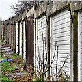
Henfield, Sussex - lock-up garages off Staples Barn
Image: © Ian Hawfinch
Taken: 9 Feb 2020
0.07 miles


