1
Houses, Blackgate Lane, Henfield
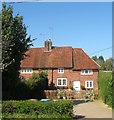
A set of three semi-detached Edwardian villas built in the first decade of the 20th century. The trees on the right split the access road for houses in the lane from the old track that now serves as a public footpath.
Image: © Simon Carey
Taken: 21 May 2017
0.01 miles
2
Greater Celandine - Chelidonium majus
Image: © Ian Hawfinch
Taken: 1 May 2009
0.01 miles
3
Marsh Marigold - Caltha palustris
Image: © Ian Hawfinch
Taken: 2 Apr 2009
0.02 miles
4
Blackgate Lane, Henfield
A footpath that runs south from Cagefoot Lane to Nep Town Road. For much of its length it is split into two with an eastern part providing access to houses.
Image: © Simon Carey
Taken: 25 Mar 2017
0.02 miles
5
Hewitts, Henfield, Sussex
Image: © Ian Hawfinch
Taken: 7 Feb 2020
0.03 miles
6
Former Baptist Chapel, Blackgate Lane, Henfield
The corrugated iron chapel was opened in 1897 and was known as the Rehoboth Baptist Chapel for many years until its closure in 1990. The former chapel was accessed via a drive from Blackgate Lane, however, this view, currently the only one, is from Hewitts to the east.
Image: © Simon Carey
Taken: 9 Jul 2017
0.03 miles
7
House on Nep Town Road
Image: © Ian Hawfinch
Taken: 4 May 2021
0.05 miles
8
Tudor Cottage, Nep Town Road, Nep Town, Henfield
Originally a timber framed building from the 17th century that has been refronted with bricks. This is the eastern side of a semi-detached building that also includes Rapley Cottage.
Image: © Simon Carey
Taken: 9 Apr 2017
0.05 miles
9
Pendrells, Nep Town Road, Nep Town, Henfield
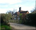
Viewed from the entrance in Blackgate Lane. The house dates from the late 17th century.
Image: © Simon Carey
Taken: 25 Mar 2017
0.05 miles
10
Hedgecocks Cottages, Nep Town Road, Nep Town
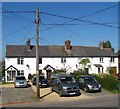
Not marked on Henfield's 1844 tithe map but do appear on the 1875-76 OS map which will give some idea of when this terrace was constructed.
Image: © Simon Carey
Taken: 9 Apr 2017
0.05 miles


