IMAGES TAKEN NEAR TO
Wheatsheaf Road, HENFIELD, BN5 9AR

Introduction

This page details the photographs taken nearby to Wheatsheaf Road, BN5 9AR by members of the Geograph project.

The Geograph project started in 2005 with the aim of publishing, organising and preserving representative images for every square kilometre of Great Britain, Ireland and the Isle of Man.

There are currently over 7.5m images from over14,400 individuals and you can help contribute to the project by visiting https://www.geograph.org.uk

Image Map


Images are licensed for reuse under creativecommons.org/licenses/by-sa/2.0
Notes
  • Clicking on the map will re-center to the selected point.
  • The higher the marker number, the further away the image location is from the centre of the postcode.

Image Listing (17 Images Found)

Images are licensed for reuse under creativecommons.org/licenses/by-sa/2.0
Image
Details
Distance
1
Green Mead
The name of the field according to Henfield's 1844 tithe map that is bounded to the south east by Image, the south west by Image, the west by Image and the north by Image
Image: © Simon Carey Taken: 18 Jun 2017
0.07 miles
2
Old Mead
The name of the field according to Henfield's 1844 tithe map that is bounded to the north by Image, to the south east by Firtree Wood and to the south west by Image The roof in the distance belongs to a house called Shiprods.
Image: © Simon Carey Taken: 18 Jun 2017
0.07 miles
3
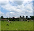
Outbuilding at Shiprods Farm
Image: © Ian Hawfinch Taken: 5 Apr 2020
0.12 miles
4
Alpacas to the south of Shiprods Farm
I did a bit of googling just to be sure that these aren't llamas. Apparently llamas have longer, banana-shaped ears - and longer, more kangaroo-like faces.
Image: © Ian Hawfinch Taken: 5 Apr 2020
0.13 miles
5
Shiprods Farm
There has been a farm here since at least the 12th century and the current farmhouse, whose chimney can be seen to the rear, dates back to the 16th. The name derives from an area of land that was cleared for sheep farming.
Image: © Simon Carey Taken: 18 Jun 2017
0.14 miles
6
Play castle near Shiprods farmhouse
I assume this is some kind of children's play castle - maybe an upscale Wendy House?
Image: © Ian Hawfinch Taken: 5 Apr 2020
0.15 miles
7
Sheep resting in the shade
On the right of the photograph you can see the spire of St Hugh's Charterhouse monastery.
Image: © Ian Hawfinch Taken: 5 Apr 2020
0.16 miles
8
Shiprods farmhouse
Image: © Ian Hawfinch Taken: 5 Apr 2020
0.17 miles
9
The Moors
The name of the field according to Henfield's 1844 tithe map that has now been turned into a small lake fed by Image
Image: © Simon Carey Taken: 18 Jun 2017
0.18 miles
10
Footpath to Shiprods Farm
Looking north as the footpath makes its way through a meadow.
Image: © Simon Carey Taken: 1 Apr 2006
0.19 miles