IMAGES TAKEN NEAR TO
Greenleaves, Clays Hill, STEYNING, BN44 3XA
Introduction
This page details the photographs taken nearby to Greenleaves, Clays Hill, BN44 3XA by members of the Geograph project.
The Geograph project started in 2005 with the aim of publishing, organising and preserving representative images for every square kilometre of Great Britain, Ireland and the Isle of Man.

There are currently over 7.5m images from over14,400 individuals and you can help contribute to the project by visiting https://www.geograph.org.uk
Image Map
Images are licensed for reuse under creativecommons.org/licenses/by-sa/2.0
Notes
- Clicking on the map will re-center to the selected point.
- The higher the marker number, the further away the image location is from the centre of the postcode.
Image Listing (128 Images Found)
Images are licensed for reuse under creativecommons.org/licenses/by-sa/2.0
Image
Details
Distance
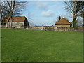
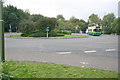
1
House between Clays Hill and Maudlin Lane
Image: © Ian Hawfinch
Taken: 21 Mar 2020
0.02 miles
2
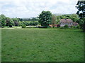
The Monarch's Way passes Maudlin Cottage
The route continues along footpath 2295 towards Bramber
Image: © Peter Holmes
Taken: 5 Jul 2008
0.06 miles
3
High wall of Bramber Castle reaching above the tree line
The tower of St Nicholas Church is on the right.
Image: © Dave Spicer
Taken: 12 Feb 2011
0.07 miles
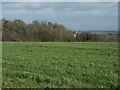
4
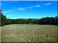
Church Gardens/Hundred Acres
The name of the fields according to Bramber's 1839 tithe map that have been merged to form a larger unit. Church Gardens was at the foot of the slope with Hundred Acres, real size 12 acres, to the right adjacent to Maudlin Lane.
Image: © Simon Carey
Taken: 30 Jul 2020
0.07 miles
5
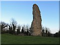
Remains of Bramber Castle: West Sussex
An evening shot of a part of the ruins. This castle is situated between the centre and north eastern section of the grid square.
Image: © Pam Brophy
Taken: 16 Apr 2005
0.08 miles
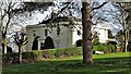
6
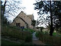
Castle Church : Bramber (West Sussex)
This church is apparently 1000 years or so old and was built as part of the castle residences and buildings. It is situated at the foot of the castle and in the centre to north eastern section of the square.
Image: © Pam Brophy
Taken: 16 Apr 2005
0.08 miles
9
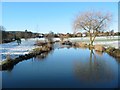
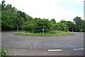
The Pond
Actually a wide portion of a slowly moving stream through this lovely piece of open land on the edge of Steyning.
Image: © Doug Thompson
Taken: 19 Dec 2009
0.08 miles