IMAGES TAKEN NEAR TO
The Ridings, STEYNING, BN44 3PX
Introduction
This page details the photographs taken nearby to The Ridings, BN44 3PX by members of the Geograph project.
The Geograph project started in 2005 with the aim of publishing, organising and preserving representative images for every square kilometre of Great Britain, Ireland and the Isle of Man.

There are currently over 7.5m images from over14,400 individuals and you can help contribute to the project by visiting https://www.geograph.org.uk
Image Map
Images are licensed for reuse under creativecommons.org/licenses/by-sa/2.0
Notes
- Clicking on the map will re-center to the selected point.
- The higher the marker number, the further away the image location is from the centre of the postcode.
Image Listing (31 Images Found)
Images are licensed for reuse under creativecommons.org/licenses/by-sa/2.0
Image
Details
Distance
2
Edward House, Sopers Lane, Bramber
Converted from an older outbuilding once belonging to Maudlin House.
Image: © Simon Carey
Taken: 30 Jul 2020
0.08 miles
3
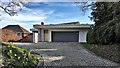
House and garage on the Sopers Lane
I assume there is a modernist house behind the modernist garage.
Image: © Ian Hawfinch
Taken: 21 Mar 2020
0.10 miles
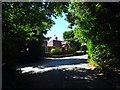
4
Maudlyn Parkway, Bramber
A cul de sac built in the 1960s in the grounds of the former Maudlin House which has now been converted into three residences.
Image: © Simon Carey
Taken: 30 Jul 2020
0.10 miles
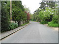
5
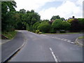
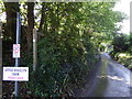
The Monarch's Way on Sopers Lane
Looking west along bridleway 2292 which is now a metaled road the route passes Maudlyn Parkway.
Image: © Peter Holmes
Taken: 5 Jul 2008
0.11 miles
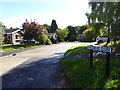
6
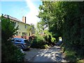
Maudlyn Close at the junction of Maudlin Lane
Image: © David Howard
Taken: 19 May 2013
0.12 miles
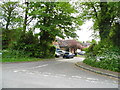
8
Kingsmead Lodge, Maudlin Lane, Bramber
Former lodge built in the first decade of the 20th century to serve a large house called Kingsmead whose land has since become a small cul de sac called Kingsmead Close.
Image: © Simon Carey
Taken: 30 Jul 2020
0.14 miles
10
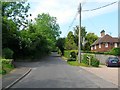
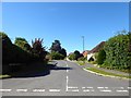
Bostal Road, Steyning
Heading west from Image eventually climbing Steyning Round Hill then turning south over the Downs to Sompting. Droveside Cottage is the dwelling on the right.
Image: © Simon Carey
Taken: 29 May 2016
0.16 miles