IMAGES TAKEN NEAR TO
Penlands Way, STEYNING, BN44 3PN
Introduction
This page details the photographs taken nearby to Penlands Way, BN44 3PN by members of the Geograph project.
The Geograph project started in 2005 with the aim of publishing, organising and preserving representative images for every square kilometre of Great Britain, Ireland and the Isle of Man.

There are currently over 7.5m images from over14,400 individuals and you can help contribute to the project by visiting https://www.geograph.org.uk
Image Map
Images are licensed for reuse under creativecommons.org/licenses/by-sa/2.0
Notes
- Clicking on the map will re-center to the selected point.
- The higher the marker number, the further away the image location is from the centre of the postcode.
Image Listing (119 Images Found)
Images are licensed for reuse under creativecommons.org/licenses/by-sa/2.0
Image
Details
Distance
4
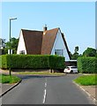
The Priest's House, Penlands Way, Steyning
Probably built as the residence of the priest for neighbouring Image though I've been unable to determine whether it is still used for that purpose.
Image: © Simon Carey
Taken: 5 Jun 2016
0.03 miles
6
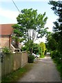
Penlands Close, Steyning
An unmade cul de sac off Bostal Road that was developed in the 1960s.
Image: © Simon Carey
Taken: 29 May 2016
0.04 miles
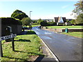
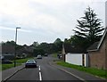
7
Penlands Way, Steyning
Looking towards the junction with Bramber Road. Built as the access road to the Penlands estate that was constructed in the 1960s.
Image: © Simon Carey
Taken: 5 Jun 2016
0.04 miles
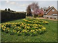
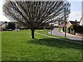
8
Shrouded cross, Steyning
In the grounds of the Roman Catholic church. Edging in on the left is probably the priest's house - it has a path direct to the church, out of shot on the right.
Image: © Robin Webster
Taken: 4 Jun 2011
0.04 miles
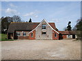
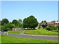
9
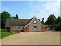
Christ the King Catholic Church, Bramber Road, Steyning
Originally a barn belonging to Penlands Farm it was converted into a church in 1951.
Image: © Simon Carey
Taken: 29 May 2016
0.05 miles
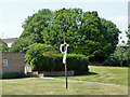
10
Greenacres, Steyning
A cul de sac off Penlands Way that was developed in the 1960s.
Image: © Simon Carey
Taken: 29 May 2016
0.05 miles