1
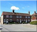
Steyning Police Station
Image: © Paul Gillett
Taken: 3 Mar 2013
0.01 miles
2
1-3, White Horse Square, Steyning
Dating from the late 18th or early 19th century and located at the junction with Charlton Street.
Image: © Simon Carey
Taken: 1 May 2016
0.01 miles
3
Houses, White Horse Square, Steyning
The three houses were built in the mid 1980s on a plot of vacant land and are from left to right: Testers, Pilgrim Cottage and Myatts. Archeological excavations carried out prior to the building suggested that this area of the town was expanded into during the 12th and 13th century and was near the site of the lost manor of Testers.
Image: © Simon Carey
Taken: 5 Jun 2016
0.01 miles
4
View east along Newham Lane
The junction ahead is with Charlton Street.
Image: © Ian Hawfinch
Taken: 21 Mar 2020
0.02 miles
5
10-11, White Horse Square, Steyning
A mock tudor building constructed during the late 1980s on the site of the former F.Duke Ltd's builders yard. White Horse Square is formed by the junctions of Sheep Pen Lane, visible in the image, Newham Lane and Charlton Street.
Image: © Simon Carey
Taken: 5 Jun 2016
0.02 miles
6
Steyning High Street, Looking South-east.
A quiet Sunday in Steyning High Street. Local transport connects it to Brighton for commuters.
Image: © Colin Smith
Taken: Unknown
0.02 miles
7
The Coach House, Sheep Pen Lane, Steyning
A former coach house that was redeveloped and converted into a residence during the early 1990s.
Image: © Simon Carey
Taken: 5 Jun 2016
0.03 miles
8
Newham House, Sheep Pen Lane, Steyning
Originally a timber framed house from the 15th or 16th century that was altered in the 18th and 20th centuries. The path on the right leads to Dog Lane.
Image: © Simon Carey
Taken: 5 Jun 2016
0.03 miles
9
Police Station, Charlton Street, Steyning
Built in the 1860s and still in use today.
Image: © Simon Carey
Taken: 1 May 2016
0.03 miles
10
Dukes Lane, Steyning
A cul de sac off Neewham Lane built in the late 1980s on the site of F.Duke Ltd.s former builders yard. Beyond the house in view the land drops down to a former brewery pond.
Image: © Simon Carey
Taken: 5 Jun 2016
0.03 miles


