IMAGES TAKEN NEAR TO
Whiterock Place, BRIGHTON, BN42 4AG

Introduction

This page details the photographs taken nearby to Whiterock Place, BN42 4AG by members of the Geograph project.

The Geograph project started in 2005 with the aim of publishing, organising and preserving representative images for every square kilometre of Great Britain, Ireland and the Isle of Man.

There are currently over 7.5m images from over14,400 individuals and you can help contribute to the project by visiting https://www.geograph.org.uk

Image Map


Images are licensed for reuse under creativecommons.org/licenses/by-sa/2.0
Notes
  • Clicking on the map will re-center to the selected point.
  • The higher the marker number, the further away the image location is from the centre of the postcode.

Image Listing (189 Images Found)

Images are licensed for reuse under creativecommons.org/licenses/by-sa/2.0
  • ...
Image
Details
Distance
1
Electricity sub station, Whiterock Place
Image: © Alex McGregor Taken: 11 Feb 2013
0.04 miles
2
Looking north on Colebrook Road
Image: © Shazz Taken: 29 Aug 2016
0.05 miles
3
Railway bridge over Station Road, Southwick
Image: © John Lucas Taken: 17 Oct 2008
0.05 miles
4
Whiterock Place
An old residential road dating from the 1850s when the area south of the railway was developed. Much of the original Victorian housing was cleared in the 1960s to make way for flats. The road itself begins at Station Road then changes its name to The Gardens at the junction with Colebrook Road and heads eastwards to join the A259 near Fishersgate.
Image: © Simon Carey Taken: 2 Dec 2010
0.05 miles
5
Southwick, Schooner Inn
Public house on Albion Street. Central rectangular counter with eating and drinking areas front, right and back; excellent views across the harbour. Cask ales on offer at my visit: Downlands Thirteen, Franklin's F.
Image: © Mike Faherty Taken: 7 Apr 2018
0.06 miles
6
Flats in Whiterock Place, Southwick
Image: © nick macneill Taken: 20 Jan 2012
0.07 miles
7
Arrow Tyres on Albion Street, Southwick
Image: © Richard Cooke Taken: 5 Jun 2018
0.07 miles
8
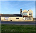
144, Albion Street, Southwick
Home to Arrow Tire Services with the section on the left once a 19th century smithy.
Image: © Simon Carey Taken: 17 May 2020
0.07 miles
9
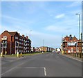
Albion Street, Southwick
The main A259 was once the town centre of Southwick with 19th century shops and terraced housing squeezed between the road and the railway. All that survives is the Old Town Hall, covered in scaffolding to the right, the rest was cleared in the 1960s with the shops moved to Southwick Square and the housing replaced by flats, Rocks Close on the left being one of nine blocks built in the same area between the road and the railway.
Image: © Simon Carey Taken: 9 May 2020
0.07 miles
10
Cat Mews, Riverside, Southwick
Built in 2001 on the site of a former Shipbrokers. Riverside is the remnant of an old coastal turnpike route.
Image: © Simon Carey Taken: 17 May 2020
0.08 miles
  • ...