
IMAGES TAKEN NEAR TO
Juniper Close, BRIGHTON, BN41 2GS
Introduction
This page details the photographs taken nearby to Juniper Close, BN41 2GS by members of the Geograph project.
The Geograph project started in 2005 with the aim of publishing, organising and preserving representative images for every square kilometre of Great Britain, Ireland and the Isle of Man.

There are currently over 7.5m images from over14,400 individuals and you can help contribute to the project by visiting https://www.geograph.org.uk
Image Map
Images are licensed for reuse under creativecommons.org/licenses/by-sa/2.0
Notes
- Clicking on the map will re-center to the selected point.
- The higher the marker number, the further away the image location is from the centre of the postcode.
Image Listing (28 Images Found)
Images are licensed for reuse under creativecommons.org/licenses/by-sa/2.0
Image
Details
Distance
1
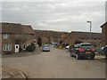
Thornbush Crescent, Portslade
Street in the Downs Park area of Portslade backing on to downland
Image: © Paul Gillett
Taken: 9 Mar 2012
0.04 miles
2
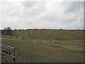
Farmland north of Portslade
Downland view from Thornbush Crescent
Image: © Paul Gillett
Taken: 9 Mar 2012
0.06 miles
3
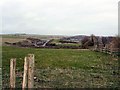
Downland north of Portslade
view from near Foredown Tower
Image: © Paul Gillett
Taken: 9 Mar 2012
0.14 miles
4
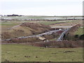
Road junction on the A27 north of Portslade
The slip road would normally by empty on Boxing Day, but a road closure meant all westbound traffic left the road here.
Image: © nick macneill
Taken: 26 Dec 2010
0.14 miles
5
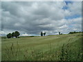
Downland south of the A27
Heading north from Sainsbury's, Hove
Image: © Paul Gillett
Taken: 20 Jun 2009
0.16 miles
6
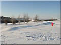
Benfield Valley Golf Course
This is the ninth hole of nine on a course that was laid out in the early 1990s using some of the older abandoned fairways of West Hove Golf Course. The latter relocated to land north of the A27 when that road was constructed having been split in two by it and lost some more land to the Hangleton Link Road. The view takes in Foredown Tower on the left and Southwick Hill in the distance on the right.
Image: © Simon Carey
Taken: 7 Jan 2010
0.16 miles
7
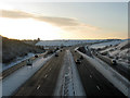
Hangleton Interchange
Where the A27 meets the A293 both new roads constructed in the early 1990s as part of the Brighton by-pass. Foredown Hill and Tower are beyond.
Image: © Simon Carey
Taken: 7 Jan 2010
0.17 miles
8
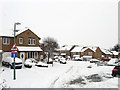
Crest Way
Built in the 1990s on the site of the former Foredown Hospital which had been opened in 1883 to treat infectious diseases. The hospital continued in use until the 1980s and was demolished in 1989 leaving only the former water tower, added in 1909, as a reminder.
Image: © Simon Carey
Taken: 2 Dec 2010
0.17 miles
10
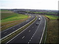
A27(T) dual carriageway
Looking east towards the slip road for the A293 Hangleton Link Road.
Image: © Peter Holmes
Taken: 26 Jan 2008
0.17 miles