1
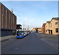
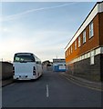
North Street, Portslade-By-Sea
Linking Church Road, the A293, in the west to Station Road/Boundary Road, the B2194, in the east. This section in view is between West Street and George Street.
The area between Station Road in the east, Church Road in the west and St Andrew's Road to north was once a community of tight knit terraced housing that made up the settlement of Portslade-By-Sea. The vast majority were demolished in the 1950s as slum housing and the area given over to business units and small factories. Only a few houses on the southern side of the A259 along with Albion Street remain of the former district.
Image: © Simon Carey
Taken: 17 May 2020
0.02 miles
2
Disused Factory, Wellington Road, Portslade-By-Sea
Built in the early 1960s on the site of a former residential district. Its last occupiers was a furniture assembly firm and now awaiting new tenants.
Image: © Simon Carey
Taken: 9 Dec 2007
0.03 miles
3
George Street, Portslade-By-Sea
Small street heading northwards from North Street before turning west and becoming Ellen Street. Pretty much all of the street is in view.
The area between Station Road in the east, Church Road in the west and St Andrew's Road to north was once a community of tight-knit terraced housing that made up the settlement of Portslade-By-Sea. The vast majority were demolished in the 1950s as slum housing and the area given over to business units and small factories. Only a few houses on the southern side of the A259 along with Albion Street remain of the former district.
Image: © Simon Carey
Taken: 17 May 2020
0.04 miles
4
West Street, Portslade-By-Sea
Heading northwards from North Street before turning east and becoming Ellen Street.
The area between Station Road in the east, Church Road in the west and St Andrew's Road to north was once a community of tight knit terraced housing that made up the settlement of Portslade-By-Sea. The vast majority were demolished in the 1950s as slum housing and the area given over to business units and small factories. Only a few houses on the southern side of the A259 along with Albion Street remain of the former district.
Image: © Simon Carey
Taken: 17 May 2020
0.04 miles
5
Camden Street, Portslade-By-Sea
The street links Wellington Road to North Street. Compare with
Image from 2007 and you will find that the former Harbour View pub which survived the slum clearances of the 1950s was demolished a couple of years ago having run foul of the licensing laws and closed down.
Image: © Simon Carey
Taken: 17 May 2020
0.05 miles
6
Ellen Street
Another former residential street now flanked by two warehouses.
Image: © Simon Carey
Taken: 9 Dec 2007
0.05 miles
7
The Harbour View, Portslade, Sussex
Located at the end of Camden Street, at the junction with Wellington Road.
Image: © Peter Trimming
Taken: 17 Apr 2010
0.05 miles
8
Majestic Bathrooms, North Street
On the junction with Middle Street. North Street was once a residential street that was cleared sometime in the late 1950s early 1960s and turned into warehouses and factories.
Image: © Simon Carey
Taken: 9 Dec 2007
0.05 miles
9
Camden Street, Portslade-by-Sea
A once residential street for those working in the gas works and other harbour industries now filled with warehouses and factories. The Harbour View, formerly the Alexandra Inn, the one survivor of the 1950s slum clearances.
Image: © Simon Carey
Taken: 9 Dec 2007
0.05 miles
10
Camden Street
Originally a road of Victorian terraced housing, marked as Camden Place on the 1879 6 inch map, by the time of the 1932 25 inch map it had been renamed Camden Street. It now serves South Portslade Industrial Estate.
Image: © Ian Capper
Taken: 21 Jan 2022
0.06 miles


