1
Belgrave Centre, Clarendon Place, Portslade-By-Sea
Originally a small cul-de-sac called Belgrave Square that was demolished in the 1950s and replaced by the current building which was opened in 1966 as a training centre for those with disabilities. Now boarded up awaiting demolition after plans were approved in April 2020 to build low cost housing on the site. Viewed from Wellington Road.
Image: © Simon Carey
Taken: 17 May 2020
0.01 miles
2
Wellington Road bus stop
Route 700, Coastliner to Brighton on A259.
Image: © Peter Holmes
Taken: 17 Mar 2012
0.01 miles
3
Clarendon Place, Portslade-By-Sea
A cul-de-sac heading south from North Street. The boarded up building is
Image
The area between Station Road in the east, Church Road in the west and St Andrew's Road to north was once a community of tight knit terraced housing that made up the settlement of Portslade-By-Sea. The vast majority were demolished in the 1950s as slum housing and the area given over to business units and small factories. Only a few houses on the southern side of the A259 along with Albion Street remain of the former district.
Image: © Simon Carey
Taken: 17 May 2020
0.02 miles
4
Who Left the Wardrobe Open?
Apt advertisement on Wellington Road, the A259, after 8-10 inches of snow were deposited on Brighton overnight. The billboard occupies the site of Belgrave Square built in the 1850s and demolished in the 1960s.
Image: © Simon Carey
Taken: 2 Dec 2010
0.02 miles
5
The Halfway House, Wellington Road
On the corner of Wellington Road (A259) and Station Road (B2194). Recently closed pub which would have been built to serve the residential areas to the west of it which were mostly removed in the 1950s. The pub has recently been closed and boarded up, its name referring to its siting between Brighton and Shoreham.
Image: © Simon Carey
Taken: 9 Dec 2007
0.02 miles
6
4-18, Wellington Road, Portslade-By-Sea
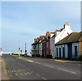
A survivor of an era when all of the area between Station Road in the east, Church Road in the west and St Andrewa's Road to north was a community of tight knit terraced housing that made up the settlement of Portslade-By-Sea. The vast majority was demolished in the 1950s as slum housing and the area given over to business units and small factories. These houses on the south side of the A259 along with Albion Street are all that remains of the former district.
Image: © Simon Carey
Taken: 17 May 2020
0.03 miles
7
Lower part of Boundary Road
Image: © Josie Campbell
Taken: 2 Aug 2011
0.03 miles
8
B2194
Image: © N Chadwick
Taken: 4 Jul 2015
0.03 miles
9
Former workshop, A259, Portslade
The workshop seems closed now, but during the seventies and eighties it was used by an Antiques restorer.
Image: © nick macneill
Taken: 2 Aug 2012
0.03 miles
10
Station Road/Boundary Road
The B2194 is single road with two names, the houses on the left are Station Road, those on the right Boundary Road. In the early 19th century the road was known as Aldrington Drove or Red House Droveway and marked the parish boundary between Portslade and Hove. The coming of the railway and the construction of Portslade station meant the route's name was changed to Station Road which remained the case until 1895 when a dispute between the two councils over who was responsible for the upkeep resulted in a change which drew the boundary down the centre of the road and split responsibility in half. The eastern side's name was changed to Boundary Road in 1903 to avoid confusion regarding stations as Station Road, Hove did not lead to Hove station though Station Road, Portslade did lead to Portslade station. This state of affairs remains the same today throughout the entire length between the A259 and the A270 though north of Portslade station the western half becomes Carlton Terrace.
The road today is the main shopping street for Portslade though this was developed only from the 1930s onwards as the original road was built with upmarket Victorian villas and began life as a purely residential district. The building on the corner was the Halfway House a pub that was built before the growth of the residential area around it being named after its position between Brighton and Shoreham. Unfortunately it closed a couple of years ago and has now been converted into offices.
Image: © Simon Carey
Taken: 2 Dec 2010
0.04 miles


