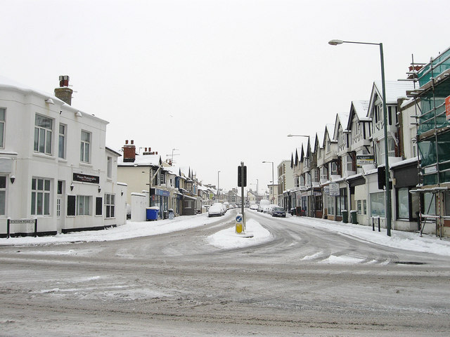
Station Road/Boundary Road
Introduction
The photograph on this page of Station Road/Boundary Road by Simon Carey as part of the Geograph project.
The Geograph project started in 2005 with the aim of publishing, organising and preserving representative images for every square kilometre of Great Britain, Ireland and the Isle of Man.
There are currently over 7.5m images from over 14,400 individuals and you can help contribute to the project by visiting https://www.geograph.org.uk

Image: © Simon Carey Taken: 2 Dec 2010
The B2194 is single road with two names, the houses on the left are Station Road, those on the right Boundary Road. In the early 19th century the road was known as Aldrington Drove or Red House Droveway and marked the parish boundary between Portslade and Hove. The coming of the railway and the construction of Portslade station meant the route's name was changed to Station Road which remained the case until 1895 when a dispute between the two councils over who was responsible for the upkeep resulted in a change which drew the boundary down the centre of the road and split responsibility in half. The eastern side's name was changed to Boundary Road in 1903 to avoid confusion regarding stations as Station Road, Hove did not lead to Hove station though Station Road, Portslade did lead to Portslade station. This state of affairs remains the same today throughout the entire length between the A259 and the A270 though north of Portslade station the western half becomes Carlton Terrace. The road today is the main shopping street for Portslade though this was developed only from the 1930s onwards as the original road was built with upmarket Victorian villas and began life as a purely residential district. The building on the corner was the Halfway House a pub that was built before the growth of the residential area around it being named after its position between Brighton and Shoreham. Unfortunately it closed a couple of years ago and has now been converted into offices.

