IMAGES TAKEN NEAR TO
Northfield Rise, HOVE, BN3 8FA
Introduction
This page details the photographs taken nearby to Northfield Rise, BN3 8FA by members of the Geograph project.
The Geograph project started in 2005 with the aim of publishing, organising and preserving representative images for every square kilometre of Great Britain, Ireland and the Isle of Man.

There are currently over 7.5m images from over14,400 individuals and you can help contribute to the project by visiting https://www.geograph.org.uk
Image Map
Images are licensed for reuse under creativecommons.org/licenses/by-sa/2.0
Notes
- Clicking on the map will re-center to the selected point.
- The higher the marker number, the further away the image location is from the centre of the postcode.
Image Listing (39 Images Found)
Images are licensed for reuse under creativecommons.org/licenses/by-sa/2.0
Image
Details
Distance
1
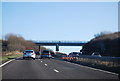
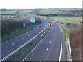
The A27(T) west of the Dyke Railway Trail bridge
Image: © Shazz
Taken: 27 Jun 2011
0.06 miles
2
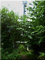
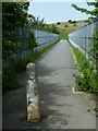
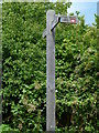
Mast by the Dyke Railway Trail
Another view of the mast is at http://www.geograph.org.uk/photo/1449556
Image: © Shazz
Taken: 27 Jun 2011
0.07 miles
3
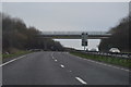
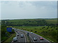
A27 near Hove
The A27 trunk road runs close to the south coast through Sussex. It by-passes Brighton and Hove using this dual-carriageway.
Image: © Malc McDonald
Taken: 9 Dec 2012
0.07 miles
5
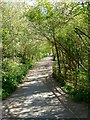
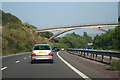
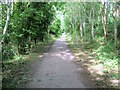
Former Dyke Railway
This section from Hangleton Way to the A27 is now paved and used as a cycle route.
Image: © Simon Carey
Taken: 15 Apr 2020
0.08 miles