IMAGES TAKEN NEAR TO
Nevill Road, HOVE, BN3 7QQ
Introduction
This page details the photographs taken nearby to Nevill Road, BN3 7QQ by members of the Geograph project.
The Geograph project started in 2005 with the aim of publishing, organising and preserving representative images for every square kilometre of Great Britain, Ireland and the Isle of Man.

There are currently over 7.5m images from over14,400 individuals and you can help contribute to the project by visiting https://www.geograph.org.uk
Image Map
Images are licensed for reuse under creativecommons.org/licenses/by-sa/2.0
Notes
- Clicking on the map will re-center to the selected point.
- The higher the marker number, the further away the image location is from the centre of the postcode.
Image Listing (48 Images Found)
Images are licensed for reuse under creativecommons.org/licenses/by-sa/2.0
Image
Details
Distance
1
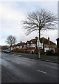
Nevill Road
This section is just beyond the junction with Frant Road and follows the crest of a hill before dipping down to cross what was once Goldstone Bottom.
Image: © Simon Carey
Taken: 18 Jan 2009
0.03 miles
2
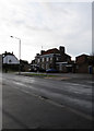
The Nevill, Nevill Road
Built in 1936 to serve the new houses being built elsewhere. The name comes from the Nevill family, Marquises of Abergavenny who were the landlords of West Blatchington Farm and once owned the land which was subsequently developed in this area. Their coat of arms still adorn the pub sign.
Image: © Simon Carey
Taken: 18 Jan 2009
0.04 miles
3
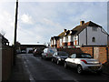
Nevill Close
Small cul-de-sac that runs south off Court Farm Road that was built in the 1930s.
Image: © Simon Carey
Taken: 18 Jan 2009
0.05 miles
4
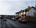
Frant Road
Small cul-de-sac that leads south of Nevill Road which was built in the 1930s. Blatchington Mill School is beyond.
Image: © Simon Carey
Taken: 18 Jan 2009
0.07 miles
5
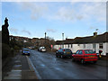
Goldstone Way
Small road linking Nevill Way with Goldstone Crescent that follows the western slope of the former Goldstone Bottom. Most of the housing was built in the 1950s.
Image: © Simon Carey
Taken: 18 Jan 2009
0.07 miles
6
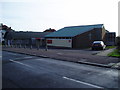
St George Roman Catholic Church on the Monarch's Way
The Monarch's way passes this modern church in Court Farm Road, West Blatchington, Hove.
Image: © Peter Holmes
Taken: 26 Jan 2008
0.08 miles
7
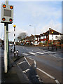
Zebra Crossing, Nevill Road
Just before the crossroads of Nevill Road with Nevill Place, to the left, and Nevill Way, to the right. This part of the road follows the course of an ancient east-west droveway which passed through the then small villages of Preston and West Blatchington. It was given the name in 1928 and the area built up from the late 1930s.
Image: © Simon Carey
Taken: 18 Jan 2009
0.10 miles
8
Nevill Road
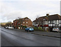
The A2023 leaves the square and is about to meet the junction with the A2038. The South Downs can be seen in the distance to the left. This part of the road was built up from the 1930s and originally Nevill Road remained the name up to the junction with Dyke Road, however, that part was renamed King George VI Avenue in 1936. The block of flats to the right are Balmoral Court.
Image: © Simon Carey
Taken: 18 Jan 2009
0.10 miles
9
Blatchington Mill School
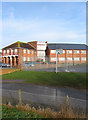
Created in 1979 from a reorganisation that saw Hove Grammar School for Boys amalgamate with next door neighbour Nevill County Secondary. This section seems to be a new part built to join together the former separate buildings. Taken from Nevill Playing Field.
Image: © Simon Carey
Taken: 18 Jan 2009
0.11 miles