
IMAGES TAKEN NEAR TO
Nevill Avenue, HOVE, BN3 7NA
Introduction
This page details the photographs taken nearby to Nevill Avenue, BN3 7NA by members of the Geograph project.
The Geograph project started in 2005 with the aim of publishing, organising and preserving representative images for every square kilometre of Great Britain, Ireland and the Isle of Man.

There are currently over 7.5m images from over14,400 individuals and you can help contribute to the project by visiting https://www.geograph.org.uk
Image Map
Images are licensed for reuse under creativecommons.org/licenses/by-sa/2.0
Notes
- Clicking on the map will re-center to the selected point.
- The higher the marker number, the further away the image location is from the centre of the postcode.
Image Listing (59 Images Found)
Images are licensed for reuse under creativecommons.org/licenses/by-sa/2.0
Image
Details
Distance
1
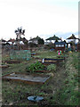
Weald Allotments
Bounded by Cranmer Avenue and Old Shoreham Road in the south, Hove Park School to the east, Holmes Avenue to the west and Nevill Avenue in the north. They have been allotments in the area since the 1890s once stretching from Nevill Road in the east to Elm Drive in the west and Nevill Road and Court Farm Road in the north, however, building developments have gradually diminished the size, Nevill Avenue's construction in the north in 1932 halved the size, housing in the 1970s plus schools and hospitals have reduced the number of plots to the current 336. This still makes it possibly the largest allotment in Brighton and Hove. The houses in view belong to Nevill Avenue.
Image: © Simon Carey
Taken: 18 Jan 2009
0.04 miles
2
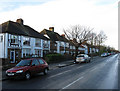
Nevill Avenue
Linking Nevill Road, the A2023, with Hangleton Road, the A2038. The road was constructed in 1932 and the houses followed soon after on land that was once allotments.
Image: © Simon Carey
Taken: 18 Jan 2009
0.05 miles
3
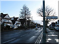
Nevill Avenue
Linking Nevill Road, the A2023, with Hangleton Road, the A2038. The road was constructed in 1932 and the houses followed soon after on land that was once allotments.
Image: © Simon Carey
Taken: 18 Jan 2009
0.06 miles
4
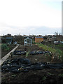
Weald Allotments
Bounded by Cranmer Avenue and Old Shoreham Road in the south, Hove Park School to the east, Holmes Avenue to the west and Nevill Avenue in the north. They have been allotments in the area since the 1890s once stretching from Nevill Road in the east to Elm Drive in the west and Nevill Road and Court Farm Road in the north, however, building developments have gradually diminished the size, Nevill Avenue's construction in the north in 1932 halved the size, housing in the 1970s plus schools and hospitals have reduced the number of plots to the current 336. This still makes it possibly the largest allotment in Brighton and Hove.
Image: © Simon Carey
Taken: 18 Jan 2009
0.07 miles
5
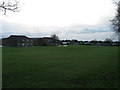
Playing Field, Hove Park School
Allotments until the 1930s when the land was given over to Hove County Grammar School for Girls. The current mixed comprehensive originated from a reorganisation in 1979.
Image: © Simon Carey
Taken: 18 Jan 2009
0.07 miles
6
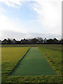
All Weather Wicket, Nevill Playing Field
The playing fields were opened in 1961 on the site of former allotments, it is large enough to contain four football pitches of two cricket pitches. This is one of two all weather wickets which is in an area of the playing fields which is currently being relaid. The houses in the background belong to Nevill Avenue.
Image: © Simon Carey
Taken: 18 Jan 2009
0.08 miles
7
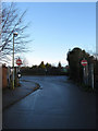
No Entry to Nevill Playing Fields
Small one way road that services Nevill Playing Fields and Aldrington County Primary School. The entrance is via Eridge Road to the north. Straight ahead is North Nevill Allotments the only surviving strip of extensive allotments that once existed here.
Image: © Simon Carey
Taken: 18 Jan 2009
0.08 miles
8
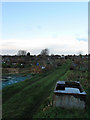
Weald Allotments
Bounded by Cranmer Avenue and Old Shoreham Road in the south, Hove Park School to the east, Holmes Avenue to the west and Nevill Avenue in the north. They have been allotments in the area since the 1890s once stretching from Nevill Road in the east to Elm Drive in the west and Nevill Road and Court Farm Road in the north, however, building developments have gradually diminished the size, Nevill Avenue's construction in the north in 1932 halved the size, housing in the 1970s plus schools and hospitals have reduced the number of plots to the current 336. This still makes it possibly the largest allotment in Brighton and Hove.
Image: © Simon Carey
Taken: 18 Jan 2009
0.09 miles
9
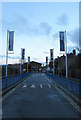
Hove Park School
Originally Hove County Grammar School for Girls until reorganisation in 1979 turned into the current mixed comprehensive.
Image: © Simon Carey
Taken: 18 Jan 2009
0.10 miles
10
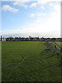
Nevill Playing Fields
Laid out in 1961 on former allotments. It is large enough for four football pitches and two cricket pitches. Most of the southern side is being relaid at the moment hence the fence. The houses in the distance are in Nevill Road whilst the chimney of the British Engineerium is to the left.
Image: © Simon Carey
Taken: 18 Jan 2009
0.10 miles