1
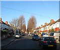
Weald Avenue, Hove
A short residential road that runs north from Old Shoreham Road to the gates of a large set of allotments. The road was developed in the 1930s and is located in the north east corner of the former parish of Aldrington.
Image: © Simon Carey
Taken: 5 Jan 2017
0.02 miles
2
Old Shoreham Road
One of the longest roads in the Brighton-Hove-Adur conurbation, stretching from the junction with New England Road in TQ3005 before ending at Kingston crossroads in TQ2306. The road itself is very ancient, following on or very near a Roman Road that once linked the Downland areas around Brighton with Chichester. Until this century much of it passed through open fields, with most of the land north of the road only being built on in the postwar years. For a long time this was the A27 until the building of the Brighton by-pass in the 1990s meant a redesignation to the A270.
Image: © Simon Carey
Taken: 14 Jan 2009
0.05 miles
3
Hove, Old Shoreham Road
A270, connecting Hove and Shoreham through Hove's northern suburbs.
Image: © Mike Faherty
Taken: 15 Sep 2018
0.06 miles
4
Old Shoreham Road, Hove
The road is ancient predating all building either side and is believed to follow an old Roman route that ran westwards to a crossing of the River Adur at Old Shoreham. Much of the housing in view was developed during the 1930s as Hove began extending northwards whilst the road itself had become the A27 which it remained until the opening of the bypass between 1991-95 after which it bcame the A270.
Image: © Simon Carey
Taken: 5 Jan 2017
0.07 miles
5
Weald Allotments
Bounded by Cranmer Avenue and Old Shoreham Road in the south, Hove Park School to the east, Holmes Avenue to the west and Nevill Avenue in the north. They have been allotments in the area since the 1890s once stretching from Nevill Road in the east to Elm Drive in the west and Nevill Road and Court Farm Road in the north, however, building developments have gradually dimished the size, Nevill Avenue's construction in the north in 1932 halved the size, housing in the 1970s plus schools and hospitals have reduced the number of plots to the current 336. This still makes it possibly the largest allotment in Brighton and Hove.
Image: © Simon Carey
Taken: 18 Jan 2009
0.07 miles
6
Playing Field, Hove Park School
The houses front onto Old Shoreham Road. Once allotments the land became part of Hove County Grammar School for Girls in the 1930s and changed to the current mixed comprehensive when the schools were reorganised in 1979.
Image: © Simon Carey
Taken: 18 Jan 2009
0.10 miles
7
Lullington Avenue, Aldrington, Hove
A residential road linking Old Shoreham Road to Amherst Crescent that was built in 1930-31.
Image: © Simon Carey
Taken: 5 Jan 2017
0.10 miles
8
Aldrington Avenue, Aldrington, Hove
A residential road linking Old Shoreham Road to Amherst Crescent that was constructed in 1930-31.
Image: © Simon Carey
Taken: 5 Jan 2017
0.10 miles
9
Milcote Avenue, Aldrington, Hove
A residential road that links Old Shoreham Road to Amherst Crescent that was constructed in 1930-31.
Image: © Simon Carey
Taken: 5 Jan 2017
0.11 miles
10
Weald Allotments
Bounded by Cranmer Avenue and Old Shoreham Road in the south, Hove Park School to the east, Holmes Avenue to the west and Nevill Avenue in the north. They have been allotments in the area since the 1890s once stretching from Nevill Road in the east to Elm Drive in the west and Nevill Road and Court Farm Road in the north, however, building developments have gradually diminished the size, Nevill Avenue's construction in the north in 1932 halved the size, housing in the 1970s plus schools and hospitals have reduced the number of plots to the current 336. This still makes it possibly the largest allotment in Brighton and Hove.
Image: © Simon Carey
Taken: 18 Jan 2009
0.11 miles


