
IMAGES TAKEN NEAR TO
Dyke Road, HOVE, BN3 6PE
Introduction
This page details the photographs taken nearby to Dyke Road, BN3 6PE by members of the Geograph project.
The Geograph project started in 2005 with the aim of publishing, organising and preserving representative images for every square kilometre of Great Britain, Ireland and the Isle of Man.

There are currently over 7.5m images from over14,400 individuals and you can help contribute to the project by visiting https://www.geograph.org.uk
Image Map
Images are licensed for reuse under creativecommons.org/licenses/by-sa/2.0
Notes
- Clicking on the map will re-center to the selected point.
- The higher the marker number, the further away the image location is from the centre of the postcode.
Image Listing (132 Images Found)
Images are licensed for reuse under creativecommons.org/licenses/by-sa/2.0
Image
Details
Distance
2
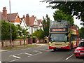
Dyke Road, Brighton
Residential road in northern Brighton. The open top bus, the "Douglas Reeve", is on the Number 77 tourist route from Brighton to Devil's Dyke on the South Downs.
Image: © Colin Smith
Taken: 31 Jul 2010
0.04 miles
3
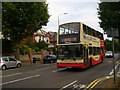
Westdene Park & Ride
Double-deck bus taking shoppers from central Brighton to the car park on the city periphery. The bus is on the residential Dyke Road, wide enough to also have a cycle lane.
Image: © Colin Smith
Taken: 31 Jul 2010
0.04 miles
4
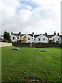
Covered Reservoir, Dyke Road
The houses beyond front onto Maldon Road.
Image: © Simon Carey
Taken: 25 Oct 2009
0.05 miles
5
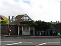
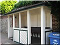
Tivoli Crescent Tram Shelter
Built around 1910 for the northern terminus of a tramline that left the Old Steine and travelled up Dyke Road. With the demise of the trams the shelter was moved back from the roadside and set in the wall and then used as a bus shelter which it remains today. In the meantime a recycling point has sprung up beside it. See http://www.mybrightonandhove.org.uk/page_id__5651.aspx#at for an older image.
Image: © Simon Carey
Taken: 25 Oct 2009
0.05 miles
6
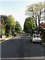
Woodruff Avenue
Residential road linking Goldstone Crescent to Dyke Road. This section lies between the junctions with Tongdean Avenue and Mallory Road and the latter. The road is a bit of a rat run between Shirley Drive and Dyke Road for those travelling into or out of town. I'll hold my hand up here as it is my favoured route between the two.
Image: © Simon Carey
Taken: 25 Oct 2009
0.07 miles
7
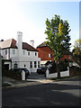
Houses, Woodruff Avenue
The collapse of the housing market obviously hasn't affected the selling of the white house.
Image: © Simon Carey
Taken: 25 Oct 2009
0.07 miles
8
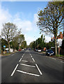
Dyke Road
The old coaching road to London via Devils Dyke, Henfield and Horsham as well as being the old boundary between the boroughs of Brighton and Hove which ran up the western side. There are cycle lanes on each side of the road but as can be seen here cars often park in them causing problems for cyclists who can often be found using this route on trips up to the Dyke.
Image: © Simon Carey
Taken: 25 Oct 2009
0.07 miles
9
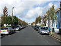
Maldon Road
Residential street linking Matlock Road to Tivoli Crescent North that was developed during the early 1890s
Image: © Simon Carey
Taken: 25 Oct 2009
0.08 miles
10
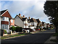
Onslow Road
Residential road that links Shirley Drive to Dyke Road. This section lies between the latter and the crossroads with Mallory Road.
Image: © Simon Carey
Taken: 25 Oct 2009
0.08 miles