
IMAGES TAKEN NEAR TO
Cissbury Road, HOVE, BN3 6EN
Introduction
This page details the photographs taken nearby to Cissbury Road, BN3 6EN by members of the Geograph project.
The Geograph project started in 2005 with the aim of publishing, organising and preserving representative images for every square kilometre of Great Britain, Ireland and the Isle of Man.

There are currently over 7.5m images from over14,400 individuals and you can help contribute to the project by visiting https://www.geograph.org.uk
Image Map
Images are licensed for reuse under creativecommons.org/licenses/by-sa/2.0
Notes
- Clicking on the map will re-center to the selected point.
- The higher the marker number, the further away the image location is from the centre of the postcode.
Image Listing (137 Images Found)
Images are licensed for reuse under creativecommons.org/licenses/by-sa/2.0
Image
Details
Distance
1
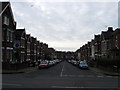
Cissbury Road
Small residential street linking Old Shoreham Road with Highdown Road and developed between 1896-1900. The roads on this small estate between here and Dyke Road are all named after Sussex hills.
Image: © Simon Carey
Taken: 15 Feb 2009
0.02 miles
2
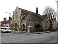
Avondale Centre, Old Shoreham Road
Currently occupied by the Grace Eyre Foundation founded as the Guardianship Society in 1914 by Grace Eyre in order to help the disabled and other handicapped people. The society changed its name in 1988 and has been using this former United Methodist church since 1950. The church itself was built in 1904.
Image: © Simon Carey
Taken: 15 Feb 2009
0.05 miles
3
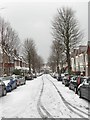
Chanctonbury Road
A residential street that originally linked Highdown Road to Old Shoreham Road though the latter junction has now been blocked off. The snow comes from the night before when it began laying around teatime the previous evening and had thawed and largely disappeared 24 hours later.
Image: © Simon Carey
Taken: 12 Mar 2013
0.05 miles
4
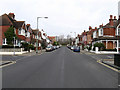
Montefiore Road
Linking Davigdor Road with Old Shoreham Road and developed between 1895-1900. Lyndhurst Road heads left, Highdown Road to the right.
Image: © Simon Carey
Taken: 15 Feb 2009
0.06 miles
5
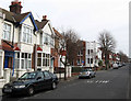
Highdown Road
Residential street linking Montefiore Road with Dyke Road and developed between 1896-1900.
Image: © Simon Carey
Taken: 15 Feb 2009
0.06 miles
6
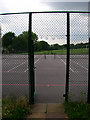
Tennis Courts, BHASVIC
BHASVIC is the commonly used acronym for Brighton Hove and Sussex Sixth Form College. The courts are situated at the Old Shoreham Road end of the substantial area of college playing fields, access to them is via the footpath Crocodile Walk. Beyond the courts are the playing fields which stretch as far as the railway marked by the line of trees at the far end.
Image: © Simon Carey
Taken: 29 Aug 2007
0.07 miles
7
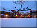
BHASVIC
Or Brighton and Hove Sixth Form College to give the full title but known throughout the city by its acronym. This is the rear view from Crocodile Walk.
Image: © Simon Carey
Taken: 2 Feb 2009
0.07 miles
8
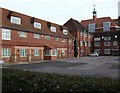
BHASVIC College
viewed from the Old Shoreham Road
Image: © Paul Gillett
Taken: 31 Jan 2010
0.08 miles
9
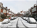
Wolstonbury Road
A residential road linking Highdown Road to Old Shoreham Road. The buildings at the end of the street belong to BHASVIC, a local sixth form college.
Image: © Simon Carey
Taken: 12 Mar 2013
0.08 miles
10

Grace Eyre Foundation base
Grace Eyre is a charity supporting people with learning disabilities to make the most of opportunities in their communities. We provide person centred services to 200 people, employ 80 staff and are supported by over 50 volunteers http://www.grace-eyre.org/aboutus/default.htm, the Hove base of the charity is a former united methodist church
Image: © Paul Gillett
Taken: 31 Jan 2010
0.09 miles