1
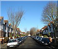
Worcester Villas - Portslade
Image: © Bob Parkes
Taken: 9 Nov 2007
0.00 miles
2
Worcester Villas, Aldrington, Hove
A residential road that links New Church Road, the B2066, with Portland Road that was developed in the first decade of the 20th century. See http://regencysociety-jamesgray.com/volume16/source/jg_16_069.html for a similar view taken in 1914.
Image: © Simon Carey
Taken: 22 Dec 2016
0.02 miles
3
Leicester Villas, Aldrington, Hove
A residential road linking New Church Road, the B2066, with Portland Road that was laid out on the 1911 OS map but not completed until the 1920s.
Image: © Simon Carey
Taken: 22 Dec 2016
0.04 miles
4
Blackberry Way, Aldrington, Hove
The unofficial name given to the service road for shops fronting onto Boundary Road. I'm sure there is a Roy Wood joke to be had here but I can't think of one.
Image: © Simon Carey
Taken: 22 Dec 2016
0.06 miles
5
Portland Road
Portland Road with Portslade Station by the Bus Stop.
Image: © Bob Parkes
Taken: 9 Nov 2007
0.07 miles
6
Garage, Leicester Villas, Aldrington, Hove
Adorned with a rather colourful owl painted by local artist, Harpoart. The garage is located at the end of the access drive to St Christopher's School playing field.
Image: © Simon Carey
Taken: 22 Dec 2016
0.07 miles
7
430-434, Portland Hove, Aldrington, Hove
A row of shops located between Blackberry Way and Worcester Villas that were built in the first decade of the 20th century.
Image: © Simon Carey
Taken: 22 Dec 2016
0.07 miles
8
Portslade Level Crossing & Station
The west coastway line crossing Boundary Road
Image: © Paul Gillett
Taken: 26 May 2009
0.07 miles
9
Boundary Road Shopping Centre
Image: © Bob Parkes
Taken: 9 Nov 2007
0.07 miles
10
Worcester Villas
Image: © N Chadwick
Taken: 4 Jul 2015
0.08 miles


