
IMAGES TAKEN NEAR TO
Turner Place, School Road, BN3 5GF
Introduction
This page details the photographs taken nearby to Turner Place, School Road, BN3 5GF by members of the Geograph project.
The Geograph project started in 2005 with the aim of publishing, organising and preserving representative images for every square kilometre of Great Britain, Ireland and the Isle of Man.

There are currently over 7.5m images from over14,400 individuals and you can help contribute to the project by visiting https://www.geograph.org.uk
Image Map
Images are licensed for reuse under creativecommons.org/licenses/by-sa/2.0
Notes
- Clicking on the map will re-center to the selected point.
- The higher the marker number, the further away the image location is from the centre of the postcode.
Image Listing (125 Images Found)
Images are licensed for reuse under creativecommons.org/licenses/by-sa/2.0
Image
Details
Distance
1
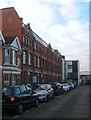
80, Stoneham Road, Aldrington, Hove
Built as a factory in 1902 and first occupied by a mineral water company from 1904-12. After the First World War it was acquired by Maynards who produced sweets as well as acting as a distribution depot for local shops. They ceased operating here in 1962 with the building eventually converted into apartments in 2002.
Image: © Simon Carey
Taken: 17 Dec 2016
0.03 miles
2
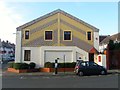
Express House, School Road, Aldrington, Hove
A small commercial unit on the corner of Milnthorpe Road built on the site of a builders yard.
Image: © Simon Carey
Taken: 17 Dec 2016
0.04 miles
3
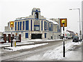
Former Granada Cinema, Portland Road
Located on the junction with School Road and still vacant five years on from Image Opened in 1933 as the Granada Cinema which remained the name until 1965 when it became the ABC until its closure in 1974 the last film shown being Callan. It was opened as a bingo hall in 1975 and passed through various companies until Gala sold the freehold to a property developer in 2003. Planning permission for demolition and building of retirement flats was refused in 2004 and the building remained idle for another few years before another bout of planning applications which have also seen a lot of opposition by locals who want to keep the landmark building intact. The longer the building remains empty the less likely this appears to happen.
Image: © Simon Carey
Taken: 2 Dec 2010
0.05 miles
4
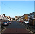
School Road, Aldrington, Hove
The road heads north from Portland Road ending at the junction with Kingsthorpe Road next to Rayford House, the large block in the distance. The western side abuts Hove Junior School and a couple of houses whilst the eastern side is largely made up of commercial buildings forming the Westerman Complex. Originally a builders yard that became home to a small works in the 1950s whose buildings were subdivided into four units housing a car accessories business and Westows, an indoor children's play area. There has been talk of demolishing these units and replacing them with housing.
Image: © Simon Carey
Taken: 17 Dec 2016
0.05 miles
5
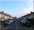
Marmion Road, Aldrington, Hove
A residential road that links School Road to Tamworth Road that had been laid out by 1911 but not completed until the end of the decade.
Image: © Simon Carey
Taken: 17 Dec 2016
0.06 miles
6
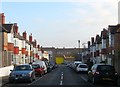
Milnthorpe Road, Aldrington, Hove
A residential road that links Grange Road to School Road that had been laid out by the time of the 1911 OS map and had little development by the time of the 1932 edition. However, the road was completed by the end of the 1930s.
Image: © Simon Carey
Taken: 17 Dec 2016
0.06 miles
7
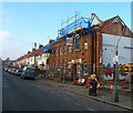
17 Marmion Road, Aldrington, Hove
In the process of being demolished. Purpose built for the YMCA in 1919 who occupied it until moving out in the summer of 2015 no longer able to justify the large expenditure on maintaining the building. The main entrance and east wing have already been demolished with the west wing about to go. Five new homes are to be built on the site.
Image: © Simon Carey
Taken: 17 Dec 2016
0.06 miles
8
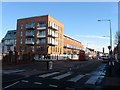
191-193, Portland Hove, Aldrington, Hove
Completed in 2015 and built on the site of Image after a long battle to try and save the old structure. The development includes 25 flats, a doctor's surgery, pharmacy and two commercial units.
Image: © Simon Carey
Taken: 14 Dec 2016
0.07 miles
9
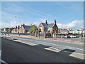
Hove Junior School
On Portland Road: http://www.hovejuniorschool.co.uk/aboutus
Image: © Mike Faherty
Taken: 15 Sep 2018
0.07 miles
10
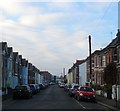
Stoneham Road, Aldrington, Hove
A reisdential road laid out around 1901-02 that runs west from Tamworth Road ending at the rear of commercial buildings that face School Road. The large building in the distance on the left is Image
Image: © Simon Carey
Taken: 17 Dec 2016
0.08 miles