1
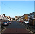
School Road, Aldrington, Hove
The road heads north from Portland Road ending at the junction with Kingsthorpe Road next to Rayford House, the large block in the distance. The western side abuts Hove Junior School and a couple of houses whilst the eastern side is largely made up of commercial buildings forming the Westerman Complex. Originally a builders yard that became home to a small works in the 1950s whose buildings were subdivided into four units housing a car accessories business and Westows, an indoor children's play area. There has been talk of demolishing these units and replacing them with housing.
Image: © Simon Carey
Taken: 17 Dec 2016
0.03 miles
2
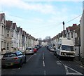
Alpine Road, Aldrington, Hove
A residential road linking Stoneham Road to Payne Avenue that was built in the first decade of the 20th century.
Image: © Simon Carey
Taken: 17 Dec 2016
0.03 miles
3
Express House, School Road, Aldrington, Hove
A small commercial unit on the corner of Milnthorpe Road built on the site of a builders yard.
Image: © Simon Carey
Taken: 17 Dec 2016
0.04 miles
4
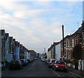
Linton Road, Hove
Taken because of the unusually blue early evening light. The shot has not been tampered with.
Image: © Stephen Richards
Taken: 26 Dec 2009
0.05 miles
5
5 new flats, Payne Avenue
Image: © Alex McGregor
Taken: 13 Aug 2014
0.05 miles
6
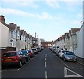
Linton Road, Aldrington, Hove
A residential road connecting Stoneham Road to Payne Avenue that was laid out in 1900 and developed soon after.
Image: © Simon Carey
Taken: 17 Dec 2016
0.05 miles
7
80, Stoneham Road, Aldrington, Hove
Built as a factory in 1902 and first occupied by a mineral water company from 1904-12. After the First World War it was acquired by Maynards who produced sweets as well as acting as a distribution depot for local shops. They ceased operating here in 1962 with the building eventually converted into apartments in 2002.
Image: © Simon Carey
Taken: 17 Dec 2016
0.05 miles
8
Milnthorpe Road, Aldrington, Hove
A residential road that links Grange Road to School Road that had been laid out by the time of the 1911 OS map and had little development by the time of the 1932 edition. However, the road was completed by the end of the 1930s.
Image: © Simon Carey
Taken: 17 Dec 2016
0.07 miles
9
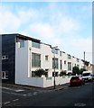
29a-29h, Stoneham Road, Aldrington, Hove
Located between Linton Road and Lennox Road and built in 2008 on the site of Stoneham Road Baptist Church that had been built in 1904. See http://www.roughwood.net/ChurchAlbum/EastSussex/Hove/Hove-Stoneham-Road-Baptist.htm
Image: © Simon Carey
Taken: 17 Dec 2016
0.07 miles
10
Stoneham Road, Aldrington, Hove
A reisdential road laid out around 1901-02 that runs west from Tamworth Road ending at the rear of commercial buildings that face School Road. The large building in the distance on the left is
Image
Image: © Simon Carey
Taken: 17 Dec 2016
0.07 miles


