IMAGES TAKEN NEAR TO
Wordsworth Street, HOVE, BN3 5BH

Introduction

This page details the photographs taken nearby to Wordsworth Street, BN3 5BH by members of the Geograph project.

The Geograph project started in 2005 with the aim of publishing, organising and preserving representative images for every square kilometre of Great Britain, Ireland and the Isle of Man.

There are currently over 7.5m images from over14,400 individuals and you can help contribute to the project by visiting https://www.geograph.org.uk

Image Map


Images are licensed for reuse under creativecommons.org/licenses/by-sa/2.0
Notes
  • Clicking on the map will re-center to the selected point.
  • The higher the marker number, the further away the image location is from the centre of the postcode.

Image Listing (118 Images Found)

Images are licensed for reuse under creativecommons.org/licenses/by-sa/2.0
  • ...
Image
Details
Distance
1
Cowper Street
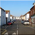
Residential street running between Rutland Road and Sackville Road with this section looking towards the latter from the crossroads with Westbourne Street. Part of the area known as Poets Corner on the account of the road names rather than any bohemian lifestyle.
Image: © Simon Carey Taken: 2 Dec 2010
0.03 miles
2
St Patricks Road, Hove
A residential street that originally linked Portland Road to Coleridge Street but has now been stopped up at the former. Built in the 1890s and located in the Poets Corner district of the city though not named after any.
Image: © Simon Carey Taken: 17 Dec 2016
0.05 miles
3
Cowper Street
Looking West down Cowper Street (Poet's Corner) from the junction of St. Patrick's Road.
Image: © Clare Tichbon Taken: 17 Feb 2008
0.05 miles
4
"The Poets' Corner" public house, Hove: decorated gable end
Image: © Jim Osley Taken: 8 Oct 2016
0.05 miles
5
Montgomery Terrace, Montgomery Street, Hove
Five houses built around 2002 on the site of a former nursing home and at least blending in with its surroundings. See also Image
Image: © Simon Carey Taken: 22 Jan 2017
0.05 miles
6
Westbourne Street, Aldrington, Hove
A residential street that connects Westbourne Gardens with Arthur Street that was built in the 1890s. Named after an ancient water filled ditch that once separated the parishes of Aldrington and Hove.
Image: © Simon Carey Taken: 17 Dec 2016
0.06 miles
7
"The Poets' Corner" public house, Hove
Dated 1886.
Image: © Jim Osley Taken: 8 Oct 2016
0.06 miles
8
"The Poets' Corner" public house, Hove: decorated gable end
Image: © Jim Osley Taken: 8 Oct 2016
0.06 miles
9
Williamson Cottage Homes, Portland Road, Hove
A set of cottage homes for women originally built in the late 1880s and largely rebuilt in 1990.
Image: © Simon Carey Taken: 14 Jan 2017
0.06 miles
10
Byron Street, Hove
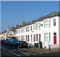
A residential street linking Sackville Road, the A2023, to Westbourne Street that was developed in the 1880s. This view is from the intersection with St Patrick's Road. Part of the district known locally as Poets Corner due to the street names as opposed to any bohemian tendencies.
Image: © Simon Carey Taken: 22 Jan 2017
0.07 miles
  • ...