1
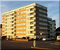
Braemore Road
The main seafront road, Kingsway, is at the end of the road, with a putting green (hidden) and beach huts beyond.
Image: © Robin Webster
Taken: 23 Mar 2010
0.05 miles
2
Braemore Road
Residential street linking Kingsway, the A259, with New Church Road, the B2066. Braemore House is the block of flats on the right.
Image: © Simon Carey
Taken: 18 Dec 2009
0.06 miles
3
Wellbeck Avenue
Residential road linking Kingsway, the A259, with New Church Road, the B2066.
Image: © Simon Carey
Taken: 18 Dec 2009
0.07 miles
4
Berridale House
Viewed from the rear of the beach huts on Western Esplanade. Between the esplanade and the A259 is a miniature golf course built on the former bed of the River Adur. The smaller block to the left is Welbeck Court which is on the corner of Welbeck Avenue.
Image: © Simon Carey
Taken: 14 Nov 2009
0.07 miles
5
239-249, Kingsway, Aldrington, Hove
Located between Berriedale Avenue and Braemore Road and built sometime during the 1920s. Houses of a similar design and age either side of these were demolished during the 1960s and 70s to make way for flats. Given the lack of space for housing in both Brighton and Hove one wonders how long these will survive before sucumbing to the same fate.
Image: © Simon Carey
Taken: 4 Dec 2016
0.07 miles
6
Western Lawns
Looking over part of Western Lawns alongside Kingsway, with Berriedale House and Braemore Court in the background.
Image: © Ian Capper
Taken: 21 Jan 2022
0.08 miles
7
Berriedale House, Kingsway, Aldrington, Hove
Built in the 1960s on the site of numbers 251-253 Kingsway, three houses which had only been built in 1927, see http://regencysociety-jamesgray.com/volume15/source/jg_15_052.html . Located on the corner of Berriedale Avenue.
Image: © Simon Carey
Taken: 4 Dec 2016
0.08 miles
8
Berriedale Avenue, Aldrington, Hove
A residential road that links Kingsway, the A259, to New Church Road, the B2066 that was developed between 1926-27.
Image: © Simon Carey
Taken: 14 Dec 2016
0.08 miles
9
Welbeck Avenue, Aldrington, Hove
A residential road that links Kingsway, the A259, to New Church Road, the B2066. The road was developed around 1926-27.
Image: © Simon Carey
Taken: 14 Dec 2016
0.08 miles
10
Berriedale House, Kingsway
Image: © N Chadwick
Taken: 4 Jul 2015
0.08 miles


