1
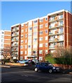
Derek House, New Church Road, Aldrington, Hove
Built on the site of former numbers 45-49 in the early 1970s. See http://regencysociety-jamesgray.com/volume15/source/jg_15_104.html for an image of the former houses. To the east is
Image and to the west is
Image
Image: © Simon Carey
Taken: 11 Dec 2016
0.04 miles
2
Derek House, New Church Rd
Image: © N Chadwick
Taken: 4 Jul 2015
0.05 miles
3
Edward House
Image: © N Chadwick
Taken: 4 Jul 2015
0.05 miles
4
Lawrence Road, Aldrington, Hove
A residential road that runs between Rutland Gardens and Hogarth Road. The eastern end in view had been developed as far as Raphael Road by the 1911 OS map with the rest completed by the 1920s. Named after portriatist Sir Thomas Lawrence and one of a number in the vicinity named after painters.
Image: © Simon Carey
Taken: 11 Dec 2016
0.05 miles
5
51-53, New Church Road, Aldrington, Hove
Located between
Image to the west and
Image to the east these two houses dating from the Edwardian era still survive.
Image: © Simon Carey
Taken: 11 Dec 2016
0.05 miles
6
Coastal Place, New Church Road, Aldrington, Hove
Occupying the former sites of numbers 55-61 New Church Road. Number 55 was located on the eastern side and was built just before the start of the First World War in large grounds. The house was demolished in the mid 1960s but remained vacant for another decade until the plot was purchased by Nuffield Hospital, a private medical institution. They opened in 1976 and operated here until 2004 when patients were moved to a larger modern block in Woodingdean. The hospital was demolished around 2006. Numbers 59-61 were built at the same time as neighbouring
Image and survived into the 1980s when they too were demolished for an extension to the hospital. The flats contain 70 homes and were constructed around 2007-08.
See http://regencysociety-jamesgray.com/volume15/source/jg_15_136.html for an image of number 55.
Image: © Simon Carey
Taken: 11 Dec 2016
0.06 miles
7
Lawrence Road
Image: © Oast House Archive
Taken: 16 Oct 2010
0.06 miles
8
Edward House, New Church Road, Aldrington, Hove
A large block of flats built in the early 1970s on the site of 41-43 New Church Road. Located between
Image to the west and
Image to the east. See http://regencysociety-jamesgray.com/volume15/source/jg_15_105.html for number 43 originally built in the 1890s.
Image: © Simon Carey
Taken: 11 Dec 2016
0.07 miles
9
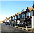
7-21, Richardson Road, Aldrington, Hove
A small parade of shops on the eastern side of the road. Number 7 is a butcher, number 9 an organic and artisan grocer, 11 a beauty salon, 13 has been converted into a residence, 15 is a newsagent, 17 was a fishmonger but appears to have closed, 19 is an estate agent and 21 is a chiropodist. Richardson Road connects New Church Road to Lawrence Road and was completed by 1913.
Image: © Simon Carey
Taken: 11 Dec 2016
0.08 miles
10
63-65, New Church Road, Aldrington, Hove
A pair of Edwardian villas located between
Image to the west and
Image to the east.
Image: © Simon Carey
Taken: 11 Dec 2016
0.08 miles


