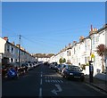
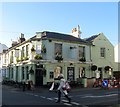
IMAGES TAKEN NEAR TO
Belfast Street, HOVE, BN3 3YS

Introduction

This page details the photographs taken nearby to Belfast Street, BN3 3YS by members of the Geograph project.

The Geograph project started in 2005 with the aim of publishing, organising and preserving representative images for every square kilometre of Great Britain, Ireland and the Isle of Man.

There are currently over 7.5m images from over14,400 individuals and you can help contribute to the project by visiting https://www.geograph.org.uk

Image Map


Images are licensed for reuse under creativecommons.org/licenses/by-sa/2.0
Notes
  • Clicking on the map will re-center to the selected point.
  • The higher the marker number, the further away the image location is from the centre of the postcode.

Image Listing (175 Images Found)

Images are licensed for reuse under creativecommons.org/licenses/by-sa/2.0
  • ...
Image
Details
Distance
1
Stirling Place
Small workers terraced housing from the Victorian era now desirable family homes.
Image: © Simon Carey Taken: 3 Feb 2007
0.04 miles
2
Connaught Terrace, Hove
A residential street linking Stirling Place to Blatchington Road that was developed in the early 1880s.
Image: © Simon Carey Taken: 18 Feb 2017
0.04 miles
3
"The Foragers" public house, Hove
Image: © Jim Osley Taken: 1 Jan 2017
0.05 miles
4
The Foragers, Stirling Place, Hove
Located on the corner of Stirling Place and Connaught Terrace the pub opened as the Stirling Arms in 1884. The name change occurred in 2006.
Image: © Simon Carey Taken: 18 Feb 2017
0.05 miles
5
Bird murals, Hove
Painted on a rendered end-of-terrace wall in Belfast Street, Hove
Image: © Jim Osley Taken: 1 Jan 2017
0.05 miles
6
School Field, St Andrews Primary School
The former site of the school building which was moved northwards to accommodate the car park for the new Tesco built on the former gasworks site. The buildings on Stirling Place are straight ahead whilst the buildings of another former school, Connaught, are to the left.
Image: © Simon Carey Taken: 1 Jun 2007
0.05 miles
7
Twitten, Hove
Narrow path linking Connaught Road to Stirling Place that runs to the immediate north of Image with Image visible through the archway.
Image: © Simon Carey Taken: 18 Feb 2017
0.06 miles
8
Brooker Street, Hove
A residential street linking Stirling Place to Blatchington Road that was developed in the early 1880s.
Image: © Simon Carey Taken: 18 Feb 2017
0.07 miles
9
Housing terrace, Stirling Place, Hove
Image: © Jim Osley Taken: 1 Jan 2017
0.08 miles
10
Blatchington Road, Hove
A road that runs east from Sackville Road, the A2023, becoming Eaton Road at the junction with Denmark Villas. These houses were built in the 1860s and remain in the most cases residential despite the southern side being overwhelmingly commercial in nature.
Image: © Simon Carey Taken: 14 Jan 2017
0.08 miles
  • ...