IMAGES TAKEN NEAR TO
Sackville Road, HOVE, BN3 3HF
Introduction
This page details the photographs taken nearby to Sackville Road, BN3 3HF by members of the Geograph project.
The Geograph project started in 2005 with the aim of publishing, organising and preserving representative images for every square kilometre of Great Britain, Ireland and the Isle of Man.

There are currently over 7.5m images from over14,400 individuals and you can help contribute to the project by visiting https://www.geograph.org.uk
Image Map
Images are licensed for reuse under creativecommons.org/licenses/by-sa/2.0
Notes
- Clicking on the map will re-center to the selected point.
- The higher the marker number, the further away the image location is from the centre of the postcode.
Image Listing (128 Images Found)
Images are licensed for reuse under creativecommons.org/licenses/by-sa/2.0
Image
Details
Distance
1
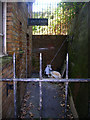
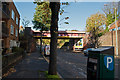
Former Public Lavatory, Sackville Road
Built into the ground floor of a block of flats erected during the 1960s on the western side of Sackville Road leading up to the railway bridge. The ladies front out onto the road whilst the gents was round the corner down an alley. Neither are in use anymore.
Image: © Simon Carey
Taken: 14 Oct 2007
0.01 miles
2
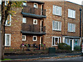
Public toilets occupy the corner of this block of flats
Sackville Road, Hove. Just below the railway bridge.
Image: © Roger A Smith
Taken: 4 Nov 2012
0.02 miles
3
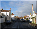
Sheridan Terrace
In the area known as Poet's Corner due to the street names all being named after poets rather than anything resembling a Bohemian lifestyle. Much of the housing is terraced built for the tradesman who serviced the great and good in the villas between Portland Road and the sea. The street runs in a crescent and starts and finishes on Coleridge Street.
Image: © Simon Carey
Taken: 14 Jan 2009
0.02 miles
6
Sackville Road
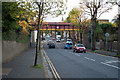
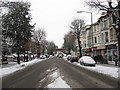
The A2023 that runs between the A259 and the A2038. Originally an ancient route that linked the small settlement of Hove with the Downs it was known as Hove Drove until changed to the current name in 1880. The girder bridge in the distance carrying the railway over the road was built in 1927 to replace the original narrow brick arch construction which was deemed too narrow to cope with existing traffic.
Image: © Simon Carey
Taken: 2 Dec 2010
0.03 miles
7
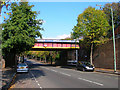
Sackville Road Bridge
Carrying the West Coastway line over the A2023. Originally an arch bridge it was replaced when the road was widened.
Image: © Simon Carey
Taken: 14 Oct 2007
0.03 miles
8
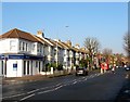
90-114, Sackville Road, Hove
A terrace of houses located north of the junction with Coleridge Street that were built in the mid 1880s.
Image: © Simon Carey
Taken: 22 Jan 2017
0.03 miles
9
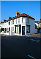
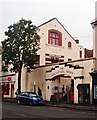
Corner Cafe, Coleridge Street
On the corner of Sheridan Terrace in the area known locally by estate agents as Poets Corner due to the naming of the streets rather than any Bohemian inclinations.
Image: © Simon Carey
Taken: 14 Oct 2007
0.04 miles