1
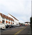
Goodwood Court, Cromwell Road
Viewed across the flat roofs of the garages in Cromwell Court. Goodwood Court is on the corner of Cromwell Road and Palmeira Place.
Image: © Simon Carey
Taken: 6 Apr 2008
0.00 miles
2
The Palmeira
On Cromwell Road
Image: © Stuart Johnson
Taken: 26 Nov 2007
0.01 miles
3
122-136, Holland Road, Hove
Houses and flats on the western side of the road as it heads towards the railway bridge. Number 136 is Jasmine Court, the larger of the two buildings. Both buildings were built on the site of a former optical works. The railway bridge at the top of the slope marks an entrance to a former station, the original Hove one which was here from 1840 to 1863 and later Holland Road Halt which closed around 1955.
Image: © Simon Carey
Taken: 25 Oct 2015
0.02 miles
4
Lorna Road
Viewed from the junction with Cromwell Road, the B2120.
Image: © Simon Carey
Taken: 11 Jan 2009
0.03 miles
5
Charter Medical Centre, Davigdor Road
Image: © Stuart Johnson
Taken: 26 Nov 2007
0.03 miles
6
Spitfire House, Davigdor Road, Hove
Located on the corner of Holland Road and built in the 1980s on the site of an old electricity works. The name derives from a story of a plane that crashed into the corner during the Second World War though it appears to have been a Bristol biplane in 1938 which probably wouldn't have sounded so good. After its construction it was used by Nurdin & peacock as a cash and carry then a series of telecom companies until its current occupiers, Marathonbet, moved in a few years ago. I'm guessing the building's primary use is for data storage.
Image: © Simon Carey
Taken: 25 Oct 2015
0.04 miles
7
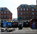
Recycling Point, Davigdor Road
Placed in the car park for Wickes DIY store on the Peacock Industrial Estate.
Image: © Simon Carey
Taken: 7 May 2006
0.04 miles
8
Holland Road Railway Bridge
Holland Road's southern end begins on the A259 and northern end ends just over the railway bridge with its junction with Lyndhurst Road as seen in the picture. In fact it originally ended at the brick wall to the left of the picture as the road originally served the first Hove station that was built in 1840 to the east of this picture. This closed in 1880 with the land around becoming a goods yard. However, another station, Holland Road Halt was built below the brick wall and opened in 1905 and remained in use until it was shut in 1956. The entrance was on the very left of the picture and required passengers to walk down a flight of steps to the wooden platforms. Nothing now remains of the halt.
Image: © Simon Carey
Taken: 22 Jan 2006
0.04 miles
9
Former Railway Arches, Peacock Industrial Estate
The only reminder of a railway coal yard that once existed on this site. The railway line is out of the picture to the right, a balustrade on Holland Road bridge is just visible. The arches were originally used to stable the horses of the yard but now are boarded up. The coal yard lasted until the early 1970s and the area is now an industrial estate and home to a DIY, bathroom and carpet warehouse.
Image: © Simon Carey
Taken: 24 Dec 2006
0.04 miles
10
Goodwood Court
Image: © N Chadwick
Taken: 13 Jul 2013
0.04 miles


