Holland Road Railway Bridge
Introduction
The photograph on this page of Holland Road Railway Bridge by Simon Carey as part of the Geograph project.
The Geograph project started in 2005 with the aim of publishing, organising and preserving representative images for every square kilometre of Great Britain, Ireland and the Isle of Man.

There are currently over 7.5m images from over 14,400 individuals and you can help contribute to the project by visiting https://www.geograph.org.uk
Holland Road Railway Bridge
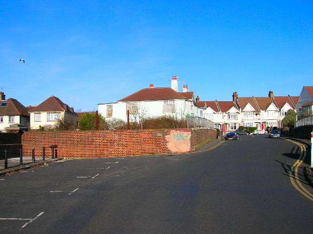
Image: © Simon Carey Taken: 22 Jan 2006
Holland Road's southern end begins on the A259 and northern end ends just over the railway bridge with its junction with Lyndhurst Road as seen in the picture. In fact it originally ended at the brick wall to the left of the picture as the road originally served the first Hove station that was built in 1840 to the east of this picture. This closed in 1880 with the land around becoming a goods yard. However, another station, Holland Road Halt was built below the brick wall and opened in 1905 and remained in use until it was shut in 1956. The entrance was on the very left of the picture and required passengers to walk down a flight of steps to the wooden platforms. Nothing now remains of the halt.
Images are licensed for reuse under creativecommons.org/licenses/by-sa/2.0
Image Location


Leaflet Map data © OpenStreetMap
Latitude
50.832711
Longitude
-0.159595