
IMAGES TAKEN NEAR TO
Selborne Road, HOVE, BN3 3AG
Introduction
This page details the photographs taken nearby to Selborne Road, BN3 3AG by members of the Geograph project.
The Geograph project started in 2005 with the aim of publishing, organising and preserving representative images for every square kilometre of Great Britain, Ireland and the Isle of Man.

There are currently over 7.5m images from over14,400 individuals and you can help contribute to the project by visiting https://www.geograph.org.uk
Image Map
Images are licensed for reuse under creativecommons.org/licenses/by-sa/2.0
Notes
- Clicking on the map will re-center to the selected point.
- The higher the marker number, the further away the image location is from the centre of the postcode.
Image Listing (306 Images Found)
Images are licensed for reuse under creativecommons.org/licenses/by-sa/2.0
Image
Details
Distance
1
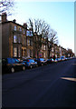
Selborne Road
This is the eastern side of the road.
Image: © Simon Carey
Taken: 3 Mar 2007
0.04 miles
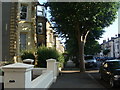
3
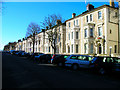
Selborne Road
Western side of the road that links Eaton Road with Church Road. The Victorian semi-detached villas are now split into flats.
Image: © Simon Carey
Taken: 3 Mar 2007
0.04 miles
4
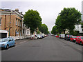
Selbourne Road
This road links Church Road to Eaton Road with the entrance to the Sussex County Cricket Ground just visible at the end of the road. The large leafy avenues are integral to the feel of Hove and gives it a separate identity to that of Brighton.
Image: © Simon Carey
Taken: 1 Jul 2007
0.04 miles
5
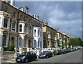
Salisbury Road
Late Victorian villas lining the western side of this road. The eastern side is a hotch potch of styles that indicate that this was the limit of the then building in this part of Hove.
Image: © Simon Carey
Taken: 2 Sep 2007
0.04 miles
6
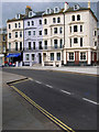
Church Road
Opposite St John the Baptist church at the start of Church Road are these mid Victorian mansions now converted into flats.
Image: © Simon Carey
Taken: 2 Sep 2007
0.06 miles
7
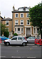
Sylvia Court, Wilbury Road
Former Edwardian townhouse now converted into flats. The minor roads were originally built quite wide which allows enough room for cars to double bank in the centre of the road.
Image: © Simon Carey
Taken: 1 Jul 2007
0.07 miles
9
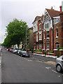
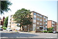
Wilbury Road - Southern End
Looking north from the junction with Church Road. The northern section of the road is mostly in TQ2905.
Image: © Simon Carey
Taken: 1 Jul 2007
0.07 miles
10
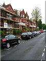
Palmeira Avenue, Western Side
The building with the scaffolding was once the home of Sir Jack Hobbs, Surrey and England cricketer. This is the point of the avenue where the red brick buildings change into the white classical design of the 1830s.
Image: © Simon Carey
Taken: 7 May 2007
0.08 miles