1
Flint Wall, Hove Street
All that remains of Hove Manor built in 1790 and demolished by the council in 1936. Hove Street was the original village street of Hove which a cluster of cottages, an inn and the manor stood. Today nothing remains of the original village except this wall.
Image: © Simon Carey
Taken: 1 Jan 2007
0.02 miles
2
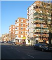
Hove Manor, Hove Street
The name Hove Manor still exists but is for these flats and parade of shops rather than the original Georgian manor house.
Image: © Simon Carey
Taken: 1 Jan 2007
0.02 miles
3
A block of flats, and the Ginger Pig restaurant, Hove Street, Hove
Image: © Ruth Sharville
Taken: 29 Sep 2023
0.03 miles
4
The Ginger Pig, Hove Street, Hove
Near the junction with Kingsway is The Ginger Pig gastro pub part of the local Gingerman Restaurant chain that also owns three others in and around Brighton. Originally known as the Ship the current building dates from around 1920 when it was rebuilt and set back due to the widening and straightening of Hove Street. The building it replaced had dated from 1702 and had been the local village inn. See http://regencysociety-jamesgray.com/volume12/source/jg_12_170.html for a view of the original building.
Image: © Simon Carey
Taken: 18 Feb 2017
0.03 miles
5
Flats on Hove Street
Image: © Paul Gillett
Taken: 5 Mar 2016
0.04 miles
6
Vallance Gardens
Named after the local landowner who owned nearby Hove Manor at the time of development. This is part of the Cliftonville estate developed in the mid 19th century.
Image: © Simon Carey
Taken: 1 Jan 2007
0.04 miles
7
Lancaster Court, Kingsway, Hove
A block of flats located between Vallance gardens and Hove Street that was built in the late 1950s. Previously it had been the site of Hove's Coastguard Cottages which were erected in 1823 and demolished in 1936, the site remaining empty for a couple of decades thereafter. A small car hire depot is located at the front of the flats.
Old Images:
Coastguard Cottages, 1912 - http://regencysociety-jamesgray.com/volume12/source/jg_12_089.html
Empty site, 1957 - http://regencysociety-jamesgray.com/volume12/source/jg_12_105.html
Image: © Simon Carey
Taken: 14 Jan 2017
0.04 miles
8
Viceroy Lodge
On the corner of Kingsway (A259) and Hove Street (A2023). Built in the late 1930s to augment the development of land to the west of Hove.
Image: © Simon Carey
Taken: 1 Jul 2007
0.05 miles
9
Hove Manor, Hove Street, Hove
Block of flats built in the 1930s on the site of the former Hove Manor that had been constructed in 1786 and demolished in 1933. See http://regencysociety-jamesgray.com/volume12/source/jg_12_153.html for a view taken in 1915, and http://regencysociety-jamesgray.com/volume12/source/jg_12_173.html for a view of the flats nearing completion in 1936.
Hove Street itself had been the old village street heading north from the beach to the Downs and had originally been narrow and possessing a bend. This disappeared in the 1920s when the street was widened and developed. In the process all the old 18th and 19th century buildings were demolished, the last going in the 1980s.
Image: © Simon Carey
Taken: 18 Feb 2017
0.05 miles
10
Viceroy Lodge - Hove Street
Image: © Mr Ignavy
Taken: 29 May 2011
0.05 miles


