Hove Manor, Hove Street, Hove
Introduction
The photograph on this page of Hove Manor, Hove Street, Hove by Simon Carey as part of the Geograph project.
The Geograph project started in 2005 with the aim of publishing, organising and preserving representative images for every square kilometre of Great Britain, Ireland and the Isle of Man.

There are currently over 7.5m images from over 14,400 individuals and you can help contribute to the project by visiting https://www.geograph.org.uk
Hove Manor, Hove Street, Hove
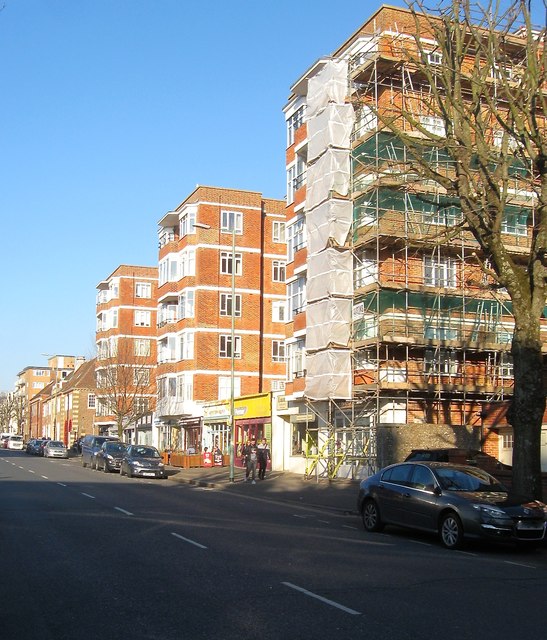
Image: © Simon Carey Taken: 18 Feb 2017
Block of flats built in the 1930s on the site of the former Hove Manor that had been constructed in 1786 and demolished in 1933. See http://regencysociety-jamesgray.com/volume12/source/jg_12_153.html for a view taken in 1915, and http://regencysociety-jamesgray.com/volume12/source/jg_12_173.html for a view of the flats nearing completion in 1936. Hove Street itself had been the old village street heading north from the beach to the Downs and had originally been narrow and possessing a bend. This disappeared in the 1920s when the street was widened and developed. In the process all the old 18th and 19th century buildings were demolished, the last going in the 1980s.
Images are licensed for reuse under creativecommons.org/licenses/by-sa/2.0
Image Location
Latitude
50.827178
Longitude
-0.17955