
IMAGES TAKEN NEAR TO
Dyke Road, HOVE, BN3 1TL
Introduction
This page details the photographs taken nearby to Dyke Road, BN3 1TL by members of the Geograph project.
The Geograph project started in 2005 with the aim of publishing, organising and preserving representative images for every square kilometre of Great Britain, Ireland and the Isle of Man.

There are currently over 7.5m images from over14,400 individuals and you can help contribute to the project by visiting https://www.geograph.org.uk
Image Map
Images are licensed for reuse under creativecommons.org/licenses/by-sa/2.0
Notes
- Clicking on the map will re-center to the selected point.
- The higher the marker number, the further away the image location is from the centre of the postcode.
Image Listing (233 Images Found)
Images are licensed for reuse under creativecommons.org/licenses/by-sa/2.0
Image
Details
Distance
1
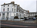
Belmont
Small cul-de-sac off Dyke Road. Built in the late 1850s on the site of Lashmar's Mill which had been removed in 1852 to Clayton where it is now better known as this, Image The houses were originally part of Hove but were moved into Brighton during the tidying up of boundaries in 1928.
Image: © Simon Carey
Taken: 15 Feb 2009
0.04 miles
2
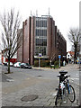
Ridgeland House
Office block on the corner of Dyke Road and Addison Road including HSBC amongst others.
Image: © Simon Carey
Taken: 15 Feb 2009
0.04 miles
3
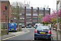
Ridgeland House, Dyke Road, Brighton
Offices and retail, seen from Russell Crescent.
Image: © Robin Webster
Taken: 30 Apr 2010
0.05 miles
4
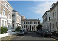
Belmont, Brighton
A cul de sac off Dyke Road built around 1858 on the site of Lashmar's Windmill. A mill had been on the site since at least 1780 with Lashmar's being possibly the third incarnation. Between 1852-53 it was moved by sledge to position on the Downs above Clayton where it still stands today and is better known as Image Numbers 2 to 6 are listed.
Image: © Simon Carey
Taken: 11 Oct 2015
0.05 miles
5
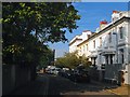
Russell Crescent, Brighton
Numbers 3, 5 and 7 in view on the right were built in 1845 and are listed. The road runs from Dyke Road to Prestonville Road.
Image: © Simon Carey
Taken: 11 Oct 2015
0.07 miles
6
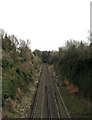
East Coastway Line
Taken from Montefiore Road bridge and looking towards the tunnel that takes it under Dyke Road and the surrounding area.
Image: © Simon Carey
Taken: 15 Feb 2009
0.07 miles
7
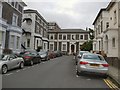
Belmont, Brighton
Cul De sac off Dyke Road near the Seven Dials
Image: © Paul Gillett
Taken: 28 Jun 2011
0.07 miles
8
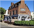
The Good Companions in Seven Dials, Brighton
A public house on the corner of Dyke Road and Russell Crescent, in the Seven Dials area of Brighton.
Image: © Mat Fascione
Taken: 24 Jun 2024
0.07 miles
9
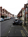
Addison Road
Looking towards the eastern junction with Dyke Road. The road was developed in the 1890s but only as far as Julian Road before it was extended to its final junction in 1902.
Image: © Simon Carey
Taken: 15 Feb 2009
0.07 miles
10
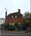
The Good Companions, Dyke Road, Brighton
Located on the corner of Russell Crescent and built by Tamplins brewery during a period expansion in the 1930s with an eye on the gentrification of public house culture in the city. Reputed to have officially opened on 3 September 1939, the day war broke out.
Image: © Simon Carey
Taken: 1 Nov 2015
0.07 miles