1
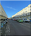
Hove: Brunswick Place
This extension of Brunswick Square north of Western Road is Grade II listed and dates from the middle of the 19th century. The picture was taken on a bright but chilly evening in early April.
Image: © John Sutton
Taken: 7 Apr 2022
0.02 miles
2
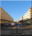
Cambridge Road Hove
Road off of Western Road
Image: © Paul Gillett
Taken: 26 May 2009
0.02 miles
3
St. Patrick's, Hove.
The photo shows the liturgical layout during the late 1980's. At this time the church was worshipped in by the local community and monks from a monastery in Cambridge Road. The church was well known for having a night shelter and other facilities to cater for the local community. The chancel is now the main worship area and the nave is now part of the shelter. The church was unusually misaligned, the liturgical east facing north.
Image: © nick macneill
Taken: Unknown
0.02 miles
4
Interior of St. Patrick's, Hove
The worship area of the Church has closed for the time being.
Image: © nick macneill
Taken: 30 Aug 2014
0.03 miles
5
High altar, St. Patrick's, Hove
Image: © nick macneill
Taken: 30 Aug 2014
0.03 miles
6
Brunswick Place, Hove
Residential street that links Western Road to Lansdowne Road that was begun in 1822 but not completed until the 1840s when the whole of the eastern side was built. All buildings either side were listed in 1950 to prevent Hove Council from demolishing them.
Image: © Simon Carey
Taken: 11 Oct 2015
0.03 miles
7
St Patrick's Church, Cambridge Road
Built in 1859 it followed the usual life of a town church until 1985 when the then vicar let two homeless people shelter for the night. Word soon spread about the refuge to the extent that in 1999 part of the church was redeveloped into a hostel and night shelter for the homeless.
Image: © Simon Carey
Taken: 3 Aug 2007
0.03 miles
8
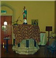
Pulpit and statue, St. Patrick's, Hove
The church has closed at least for the time being.
Although the covered edifice may look like a font it is in fact the original pulpit by G.G. Scott. As I remember it was a fairly mass produced object as one of the saints that surrounded the pulpit was misnamed. The statue above it is of St. Patrick.
Image: © nick macneill
Taken: 30 Aug 2014
0.03 miles
9
Brunswick Place - Eastern Side
Brunswick Place lies between Western Road and Lansdowne Road and was developed about 20 years after the original Brunswick Town estate south of Western Road. The original town houses have long been subdivided into flats and at one time had sunk to being a poor area of time lacking modern utilities though today they retain a certain 'seen better days' look.
Image: © Simon Carey
Taken: 3 Aug 2007
0.03 miles
10
Barneys, Western Road
Takes up the bulk of shop space between Farm Road (to the left) and Brunswick Place (out of picture to the right).
Image: © Simon Carey
Taken: 3 Jun 2007
0.04 miles


