St. Patrick's, Hove.
Introduction
The photograph on this page of St. Patrick's, Hove. by nick macneill as part of the Geograph project.
The Geograph project started in 2005 with the aim of publishing, organising and preserving representative images for every square kilometre of Great Britain, Ireland and the Isle of Man.

There are currently over 7.5m images from over 14,400 individuals and you can help contribute to the project by visiting https://www.geograph.org.uk
St. Patrick's, Hove.
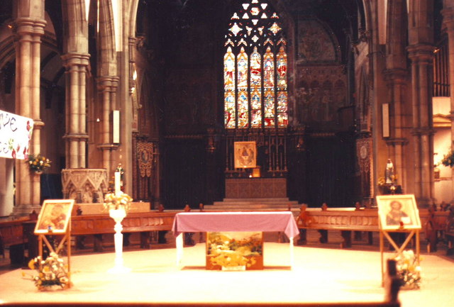
Image: © nick macneill Taken: Unknown
The photo shows the liturgical layout during the late 1980's. At this time the church was worshipped in by the local community and monks from a monastery in Cambridge Road. The church was well known for having a night shelter and other facilities to cater for the local community. The chancel is now the main worship area and the nave is now part of the shelter. The church was unusually misaligned, the liturgical east facing north.
Images are licensed for reuse under creativecommons.org/licenses/by-sa/2.0
Image Location
Latitude
50.826026
Longitude
-0.157728