IMAGES TAKEN NEAR TO
Lansdowne Square, HOVE, BN3 1HE
Introduction
This page details the photographs taken nearby to Lansdowne Square, BN3 1HE by members of the Geograph project.
The Geograph project started in 2005 with the aim of publishing, organising and preserving representative images for every square kilometre of Great Britain, Ireland and the Isle of Man.

There are currently over 7.5m images from over14,400 individuals and you can help contribute to the project by visiting https://www.geograph.org.uk
Image Map
Images are licensed for reuse under creativecommons.org/licenses/by-sa/2.0
Notes
- Clicking on the map will re-center to the selected point.
- The higher the marker number, the further away the image location is from the centre of the postcode.
Image Listing (493 Images Found)
Images are licensed for reuse under creativecommons.org/licenses/by-sa/2.0
Image
Details
Distance
1
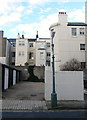
Rear of Lansdowne Square
Viewed from Alice Street.
Image: © Simon Carey
Taken: 1 Mar 2014
0.02 miles
2
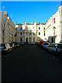
Lansdowne Square
Built as part of the Brunswick development from 1830 onwards.
Image: © Simon Carey
Taken: 3 Feb 2007
0.02 miles
3
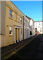
Alice Street
Small back street on the Brunswick estate linking Lansdowne Place and Holland Road. The backs of the houses in Adelaide Crescent can be seen at the end of the street.
Image: © Simon Carey
Taken: 3 Feb 2007
0.02 miles
4
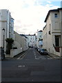
Alice Street
A minor side street linking Holland Road to Lansdowne Place. The houses at the far end of the street are the rear of the properties that face out onto Adelaide Crescent.
Image: © Simon Carey
Taken: 1 Mar 2014
0.03 miles
5
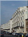
Hove: Lansdowne Place
Elegant curved frontages repeat almost endlessly as Lansdowne Place gently runs uphill from the seafront.
Image: © Chris Downer
Taken: 24 Sep 2011
0.04 miles
6
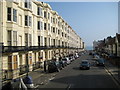
Hove: Holland Road
The two sides of Holland Road do not look as though they belong with one another. On the left are classic Victorian five storey townhouses, while on the right, and totally dominated by their elder neighbours, are Edwardian detached houses with bay windows. Holland Road is named after Lord Holland, a close friend of Sir Isaac Goldsmid, the Anglo-Jewish merchant who in 1830 bought the open countryside where the housing was subsequently developed. As Sir Isaac Goldsmid and his successors developed the surrounding area, they sought to record aspects of Anglo-Jewish history, together with the achievements of family members, in the names of the new roads that they built. So thoroughfares were named after Cromwell, Lansdowne, Palmeira, Montefiore, and Davigdor for example.
Image: © Nigel Cox
Taken: 8 Jun 2008
0.04 miles
7
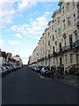
Holland Road
The road runs from the A259 northwards to Lyndhurst Road. This section between the former and Western Road has very differing architectural styles, to the right are the imposing 19th century townhouses whilst on the left the much smaller family houses built after the First World War on the former grounds to the rear of the eastern side of Palmeira Square.
Image: © Simon Carey
Taken: 1 Mar 2014
0.04 miles
8
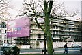
Hove: Lansdowne Hotel
The Lansdowne Hotel opened in 1854. In this 2006 photo it appears to be undergoing extensive refurbishment. It closed in 2013.
Image: © Jonathan Hutchins
Taken: 25 Nov 2006
0.04 miles
9
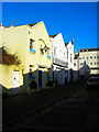
The Old Bake House, Holland Mews
Small mews between Holland Road and Lansdowne Place.
Image: © Simon Carey
Taken: 3 Feb 2007
0.05 miles