IMAGES TAKEN NEAR TO
Cavendish Mews, HOVE, BN3 1AZ
Introduction
This page details the photographs taken nearby to Cavendish Mews, BN3 1AZ by members of the Geograph project.
The Geograph project started in 2005 with the aim of publishing, organising and preserving representative images for every square kilometre of Great Britain, Ireland and the Isle of Man.

There are currently over 7.5m images from over14,400 individuals and you can help contribute to the project by visiting https://www.geograph.org.uk
Image Map
Images are licensed for reuse under creativecommons.org/licenses/by-sa/2.0
Notes
- Clicking on the map will re-center to the selected point.
- The higher the marker number, the further away the image location is from the centre of the postcode.
Image Listing (626 Images Found)
Images are licensed for reuse under creativecommons.org/licenses/by-sa/2.0
Image
Details
Distance
1
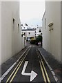
Ivy Place
View of the entrance off Waterloo Street.
Image: © Simon Carey
Taken: 20 Jul 2009
0.01 miles
2
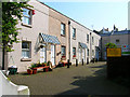
Ivy Mews
Small twentieth century mews tucked away between Waterloo Street and Little Western Street.
Image: © Simon Carey
Taken: 2 Apr 2007
0.01 miles
3
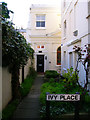
The Old School House, Ivy Place
Part of the Brunswick conservation area and squeezed between Waterloo Street and Little Western Street.
Image: © Simon Carey
Taken: 2 Apr 2007
0.02 miles
4
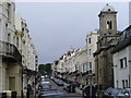
Waterloo Street, Hove
Residential street at right angles to the seafront at Hove. St Andrew's Church is on the right.
Image: © Colin Smith
Taken: 31 Jul 2010
0.02 miles
5
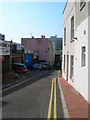
Little Western Street
Small dead end street filled with non-descript housing and garages. This street is officially part of Brighton move a few paces to the right and you enter Hove.
Image: © Simon Carey
Taken: 2 Apr 2007
0.02 miles
6
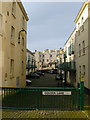
Golden Lane
A fairly recent development that straddles the old Brighton and Hove boundary that had been derelict for a number of years. A number of narrow terraces existed here until they were cleared in the 1930s and the site given over to the neighbouring Anchor Brewery which survived until the early 1950s with the buildings removed sometime in the 1960s. From that point a number of planning applications were made but none succeeded until the current one was agreed during the 1990s. Golden Lane itself was the original name of a small alley that led from Western Street to the Hove boundary which contained a pub and a smithy.
Image: © Simon Carey
Taken: 25 Jan 2014
0.03 miles
7
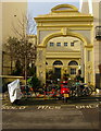
Waterloo Street Arch
Built in 1877 as an entrance to the Old Market building, which can be seen beyond, which by then was being used as a riding school. The arch fell until disrepair after the riding school closed after the First World War but was renovated in the 1980s.
Image: © Simon Carey
Taken: 25 Jan 2014
0.03 miles
8
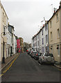
Cross Street
Linking Waterloo Street to Little Western Street.
Image: © Simon Carey
Taken: 30 Oct 2011
0.03 miles