
IMAGES TAKEN NEAR TO
Ashton Rise, BRIGHTON, BN2 9QQ
Introduction
This page details the photographs taken nearby to Ashton Rise, BN2 9QQ by members of the Geograph project.
The Geograph project started in 2005 with the aim of publishing, organising and preserving representative images for every square kilometre of Great Britain, Ireland and the Isle of Man.

There are currently over 7.5m images from over14,400 individuals and you can help contribute to the project by visiting https://www.geograph.org.uk
Image Map
Images are licensed for reuse under creativecommons.org/licenses/by-sa/2.0
Notes
- Clicking on the map will re-center to the selected point.
- The higher the marker number, the further away the image location is from the centre of the postcode.
Image Listing (566 Images Found)
Images are licensed for reuse under creativecommons.org/licenses/by-sa/2.0
Image
Details
Distance
2
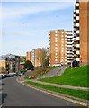
Ashton Rise, Brighton
A road that runs from John Street to the junction with Richmond Parade where it becomes Image Developed from the late 1950s onwards when much of the area was cleared of former slum housing eradicating a number of roads; Claremont Street, Claremont Row and Claremont Place in the process. The streets were replaced by high rises with three in view from right to left being Saxonbury, Courtlands and Ecclesden. On the left hand side down the slope is Ebenezer Apartments.
Image: © Simon Carey
Taken: 25 Oct 2015
0.03 miles
3
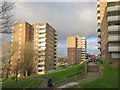
Normanhurst and Highleigh tower blocks
Image: © Oast House Archive
Taken: 5 Nov 2017
0.03 miles
4
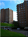
Richmond Heights and Normanhurst
Head south down Grove Hill a little way to the next blocks. Richmond Heights to the right and Normanhurst to the left. Built on the site of Cambridge and Ashton Street.
Click on the link to take you to the next page. http://www.geograph.org.uk/photo/231606
Image: © Simon Carey
Taken: 1 Sep 2006
0.03 miles
5
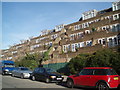
Flats in John Street
The terraced style makes these flats distinctive
Image: © Paul Gillett
Taken: 26 Oct 2009
0.04 miles
6
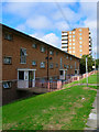
Cranbrook
Head south down Grove Hill then east up a footpath that roughly follows the course of Richmond Street then south down John Street. The tower block in the background is Normanhurst. John Street follows the course of what was once Sussex Terrace. The latter was earmarked for clearance in the 1930s but the war prevented though the council was inadvertently assisted by the Luftwaffe who bombed this area heavily. The clearances recommenced from 1959 and the flats and tower blocks went up in the 1960s.
Click on the link to take you to the next page. http://www.geograph.org.uk/photo/231610
Image: © Simon Carey
Taken: 1 Sep 2006
0.04 miles
7
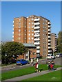
Saxonbury, Ashton Rise, Brighton
Built around 1959 as part of the Albion Hill slum clearances. Viewed from Sussex Street with John Street in the foreground. Just visible beyond is another high rise, Courtlands.
Image: © Simon Carey
Taken: 1 Nov 2015
0.04 miles
8
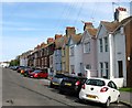
Sussex Terrace, John Street, Brighton
Originally a residential street in its own right that ran from Albion Hill to Richmond Street that was developed on the western side in the late 1850s. On the eastern side was a number of chalk pits and lime kilns which remained until the 1890s when the terrace in view was built. Numbers 1-7 on the western side were destroyed by a bomb during the Second World War and the rest were removed in the slum clearances of the early 1960s. The eastern survived also suffered with misfortune with numbers 15-16 collapsing due to a burst water main in the late 1930s and numbers 17-18 found to be unstable and demolished soon after. Numbers 19-20 were removed as slum clearances in the mid 1960s, however 21-40 survive.
Image: © Simon Carey
Taken: 25 Oct 2015
0.05 miles
9
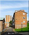
Grove Bank, Grove Hill, Brighton
A low rise block of flats that were built in the 1960s as part of the large scale redevelopment of the Albion Hill area which removed many former early 19th century slum properties. Grove bank was located on a former row houses that lined the eastern side of Richmond Buildings, another road eradicated in the clearances. Beyond is the high rise block Thorndale.
Image: © Simon Carey
Taken: 25 Oct 2015
0.05 miles
10
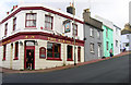
Albion Inn, Albion Hill
Turn west down a footpath that links Richmond Street to John Street then turn north until the junction with Albion Hill is reached. The latter is another step east-west route in this part of town though it marks the northern edge of the slum clearances. The Albion Inn has been known as that since the mid 19th century.
Click on the link to take you to the next page. http://www.geograph.org.uk/photo/231701
Image: © Simon Carey
Taken: 1 Sep 2006
0.05 miles