1
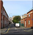
Keep to Nearside
Side prompting those participating in the Veteran car run to keep to the left hand lane, though most ignored it.
Image: © Oast House Archive
Taken: 4 Nov 2012
0.01 miles
2
Runners enter Grand Parade
after 4.5 miles of the inaugural Brighton Marathon
Image: © Paul Gillett
Taken: 18 Apr 2010
0.01 miles
3
Tulips in Victoria Gardens
The gardens have recently been relaid as part of a major road scheme
Image: © Paul Gillett
Taken: 1 May 2021
0.02 miles
4
Grand Parade, BN1
Image: © Mike Quinn
Taken: 1 May 2012
0.02 miles
5
Ebeneezer Baptist Chapel, Richmond Parade
Head north along Ashton Rise then south down Richmond Parade. The latter is the former western section of Richmond Street from which it is now cut off from. The chapel was rebuilt in the late 1960s to replace the previous building which had stood on the opposite side of the road from 1825 to 1866. This area was cleared from 1959 onwards and resulted in the construction of five tower blocks as replacements.
Click on the link to take you to the next page. http://www.geograph.org.uk/photo/231516
Image: © Simon Carey
Taken: 1 Sep 2006
0.02 miles
6
Victoria Gardens
These central gardens were originally a single large, flat, open space which joined the Steine and the Level, and which was usually known as the North Steine http://www.mybrightonandhove.org.uk/category_id__823_path__0p115p203p.aspx
Image: © Paul Gillett
Taken: 2 Jan 2011
0.03 miles
7
Ivory Place, Brighton
A cul de sac off Morley Street that was developed in the early 1820s and soon became an area of slum housing. The southern end was cleared in the 1930s with threst following in the 1950s and 60s.
Image: © Simon Carey
Taken: 4 Oct 2015
0.03 miles
8
Victoria Gardens, Brighton
Newly landscaped as part of a major development in the centre of Brighton
Image: © Paul Gillett
Taken: 25 Dec 2020
0.03 miles
9
Psychosocial, Morley Street, Brighton
The current occupants of this night club since 2012. Its most well known incarnation was as the Ocean Rooms which closed in 2010 after the violent death of a clubber.
Image: © Simon Carey
Taken: 4 Oct 2015
0.04 miles
10
Victoria Gardens
A public park that lies between the one way system of the A23 as it heads south to the Old Steine. Originally an area of marshy ground that lay next to the Whalesborne, Brighton's old river, it had become an open space by the 18th century and was enclosed in 1787 and used for fairs, exhibitions and cricket. The space was turned into a private park around 1819 and became public in the 1890s. There are two parts of the gardens, the northern and southern enclosures which are split by North Road. This forms part of the former.
Image: © Simon Carey
Taken: 25 Sep 2011
0.04 miles


