1
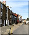
Journeys Hostel, Richmond Place
Located at the junction with Richmond Parade with St Peter's church beyond. Originally a pub called the Richmond which became a music venue and later changed its name to the Pressure Point. The latter closed in 2009 and has been converted into a backpackers hostel.
Image: © Simon Carey
Taken: 19 Nov 2011
0.01 miles
2
Richmond Place and obelisk, Brighton
The obelisk originally had drinking troughs and fountains for animals and humans. They are still there, but inoperative. The structure, erected 1871, is grade II listed.
Image: © Robin Webster
Taken: 19 Jul 2016
0.01 miles
3
Albion Street
Head west down Richmond Parade then north along Albion Street. Another street that has been extensively redeveloped and as such has become largely anonymous. The dental and doctor's surgeries to the right occupy the site of the old Albion Brewery from which the street was named.
Click on the link to take you to the next page. http://www.geograph.org.uk/photo/231518
Image: © Simon Carey
Taken: 1 Sep 2006
0.02 miles
4
Richmond Place
Developed during the 1810s next to the road from Lewes now the A270. A couple of the original buildings have extended their frontages over the former gardens to make shops.
Image: © Simon Carey
Taken: 19 Nov 2011
0.02 miles
5
Snowdog #40, near St Peter's Church
Image: © Paul Gillett
Taken: 26 Sep 2016
0.02 miles
6
Albion Street, Brighton
Built around 1815 and running from Richmond Street (now Richmond Parade) to Waterloo Street (now Phoenix Place). Near enough all of the street was demolished in the late 1950s as part of the large Albion Hill redevelopment with the exception of number 4-6 on the left, which can be seen in this 1956 image - http://regencysociety-jamesgray.com/volume27/source/jg_27_071.html. Next door is the former Stable Inn, which replaced the older Albion Inn which dated from the 1860s, which later became the Live Lounge but has closed in the last few years. Beyond was the Albion Brewery which closed in 1892 having been purchased by Tamplins who operated at the far end of the road. The buildings remained and were put to other uses until demolition in 1982, see http://regencysociety-jamesgray.com/volume27/source/jg_27_112.html , and were replaced by an Elim Church which has recently moved out and the building converted into residences.
Image: © Simon Carey
Taken: 25 Oct 2015
0.02 miles
7
Richmond Place, Brighton
Part of the A23 one way system at the northern end of Valley Gardens on the eastern side of St Peter's church. The road was developed in the 1800s and continues eastwards as Lewes Road.
Image: © Simon Carey
Taken: 4 Oct 2015
0.03 miles
8
Brighton
Awaiting the arrival of the veteran cars on a wet morning.
Image: © Peter Trimming
Taken: 6 Nov 2022
0.04 miles
9
Brighton, obelisk
Between Richmond Place and St. George's. The structure once contained drinking fountains, but these no longer work; a plaque describing them has gone.
Image: © Mike Faherty
Taken: 8 Sep 2018
0.04 miles
10
Former Public Conveniences, Victoria Gardens
At the northern end of the northern part of the gardens. They are certainly no longer open to the public though there was somebody down there when I looked down the steps. The building beyond is One Grand parade built in the 1960s and currently home to a convenience store and some empty offices. for many years there was a decent art materials shop here.
Image: © Simon Carey
Taken: 19 Nov 2011
0.04 miles


