
IMAGES TAKEN NEAR TO
Bevendean Avenue, BRIGHTON, BN2 8PE
Introduction
This page details the photographs taken nearby to Bevendean Avenue, BN2 8PE by members of the Geograph project.
The Geograph project started in 2005 with the aim of publishing, organising and preserving representative images for every square kilometre of Great Britain, Ireland and the Isle of Man.

There are currently over 7.5m images from over14,400 individuals and you can help contribute to the project by visiting https://www.geograph.org.uk
Image Map
Images are licensed for reuse under creativecommons.org/licenses/by-sa/2.0
Notes
- Clicking on the map will re-center to the selected point.
- The higher the marker number, the further away the image location is from the centre of the postcode.
Image Listing (33 Images Found)
Images are licensed for reuse under creativecommons.org/licenses/by-sa/2.0
Image
Details
Distance
1
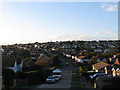
Bevendean Avenue, Saltdean
One of the original roads laid out in the 1920s that runs between Ashurst Avenue in the east to Shepham Avenue in the west. This view looks towards the crossroads with Bannings Vale. The section beyond up to the junction with Cissbury Avenue was not developed until the 1960s.
Image: © Simon Carey
Taken: 27 Oct 2012
0.04 miles
2
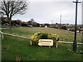
Greenacre, Northwood Avenue, Saltdean
Private Green area in the middle of the avenue, the road like several in the area remains unmade
Image: © Paul Gillett
Taken: 25 Dec 2012
0.04 miles
4
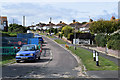
Findon Avenue, Saltdean
Unmade Road off Bevendean Avenue
Image: © Paul Gillett
Taken: 25 Dec 2012
0.05 miles
5
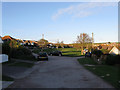
Findon Avenue, Saltdean
One of the original roads of the 1920s which along with neighbouring Image was one of the few in eastern Saltdean to be fully developed before the Second World War. Both roads remain unmade today and open out onto small greens.
Image: © Simon Carey
Taken: 27 Oct 2012
0.07 miles
6
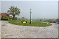
Greenacre - private property
A green with the unmade Northwood Avenue running up each side.
Image: © Robin Webster
Taken: 19 May 2010
0.07 miles
7
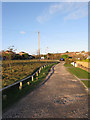
Northwood Avenue, Saltdean
One of the original roads laid out in the 1920s and like neighbouring Image was one of the few in the eastern part of Saltdean to be developed before the Second World War. The green on the left seems to be privately owned and has banned anything enjoyable from being carried out on it.
Image: © Simon Carey
Taken: 27 Oct 2012
0.08 miles
8
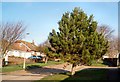
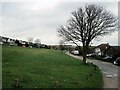
Fir Tree in Banning Vale
Taken on Christmas Day 2009
Image: © Paul Gillett
Taken: 25 Dec 2009
0.08 miles
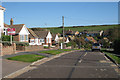
10
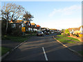
Cissbury Crescent, Saltdean
The road runs in an arc with both junctions on Bannings Vale and is one of the original ones laid out in the 1920s though this section running eastwards from Hartfield Road remained undeveloped until the mid 1960s.
Image: © Simon Carey
Taken: 27 Oct 2012
0.11 miles