IMAGES TAKEN NEAR TO
Cuckmere Court, The Furlongs, POLEGATE, BN26 5XU
Introduction
This page details the photographs taken nearby to Cuckmere Court, The Furlongs, BN26 5XU by members of the Geograph project.
The Geograph project started in 2005 with the aim of publishing, organising and preserving representative images for every square kilometre of Great Britain, Ireland and the Isle of Man.

There are currently over 7.5m images from over14,400 individuals and you can help contribute to the project by visiting https://www.geograph.org.uk
Image Map
Images are licensed for reuse under creativecommons.org/licenses/by-sa/2.0
Notes
- Clicking on the map will re-center to the selected point.
- The higher the marker number, the further away the image location is from the centre of the postcode.
Image Listing (318 Images Found)
Images are licensed for reuse under creativecommons.org/licenses/by-sa/2.0
Image
Details
Distance
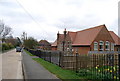
1
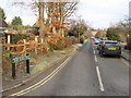
The Furlongs
A residential road that lies between Deans Road and North Road. It was marked out as early as the last decade of the 19th century but development did not commence until the 1920s when many of the cottages on the eastern side was constructed. However, the western side was not completed until the 1970s.
Image: © Simon Carey
Taken: 1 Jan 2013
0.02 miles
2
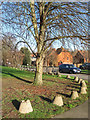
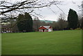
Anti-Tank Buoys, Alfriston Recreation Ground
There are 116 of these buoys lining the eastern and northern sides next to The Furlongs and North Road respectively. They would have been used as part of roadblocks during the Second World War and have probably been collected and placed here from various positions up and down the Cuckmere valley.
Image: © Simon Carey
Taken: 1 Jan 2013
0.03 miles
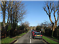
3
Saffron Gardens
Small cul de sac off The Furlongs and lying opposite Image They were built sometime in the last thirty years on the site of houses built during the 1920s.
Image: © Simon Carey
Taken: 1 Jan 2013
0.03 miles
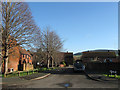
7
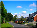
Smugglers Close
Small cul-de-sac off Deans Road in the residential part of the village.
Image: © Simon Carey
Taken: 13 Sep 2008
0.07 miles
8
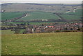
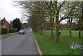
Alfriston seen from the South Downs Way above the village
Image: © N Chadwick
Taken: 14 Apr 2010
0.07 miles
9
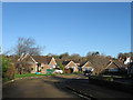
Smuggler's Close
A cul de sac off Deans Road built during the 1960s when much of the western side of the village was developed.
Image: © Simon Carey
Taken: 1 Jan 2013
0.07 miles