IMAGES TAKEN NEAR TO
Deans Road, POLEGATE, BN26 5XJ
Introduction
This page details the photographs taken nearby to Deans Road, BN26 5XJ by members of the Geograph project.
The Geograph project started in 2005 with the aim of publishing, organising and preserving representative images for every square kilometre of Great Britain, Ireland and the Isle of Man.

There are currently over 7.5m images from over14,400 individuals and you can help contribute to the project by visiting https://www.geograph.org.uk
Image Map
Images are licensed for reuse under creativecommons.org/licenses/by-sa/2.0
Notes
- Clicking on the map will re-center to the selected point.
- The higher the marker number, the further away the image location is from the centre of the postcode.
Image Listing (487 Images Found)
Images are licensed for reuse under creativecommons.org/licenses/by-sa/2.0
Image
Details
Distance
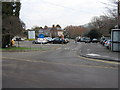
1
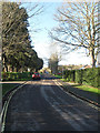
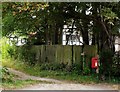
Deans Road
Residential road that headswest from a junction with Kings Ride, Star lane and Weavers Lane towards another with The Broadway. The road was laid out in the last years of the 19th century but building did not commence until after the First World War. Even then a lack of connection with utilities meant full scale development was not completed until the 1960s.
Image: © Simon Carey
Taken: 1 Jan 2013
0.03 miles
2
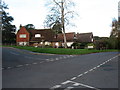
Deans Road
Residential road that runs from Star Lane up to The Broadway. Taken from the junction with Smugglers Close.
Image: © Simon Carey
Taken: 13 Sep 2008
0.04 miles
3
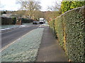
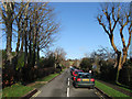
Deans Road looking west
The Mobile Library has called on a frosty January day.
Image: © Terry Head
Taken: 5 Jan 2010
0.04 miles
4
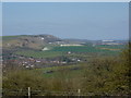
Alfriston in the Cuckmere valley
A distant view of Alfriston from 2K away,from Lullington Heath.
Image: © Peter Barr
Taken: 20 Apr 2010
0.06 miles
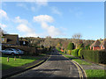
5
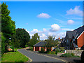
Kings Ride
The southern road of the newer part of Alfriston which was laid out at the end of the 19th century and developed after the First World War. The road is also part of the South Downs Way and can often see more pedestrian traffic than vehicle.
Image: © Simon Carey
Taken: 1 Jan 2013
0.08 miles
6
Smugglers Close
Small cul-de-sac off Deans Road in the residential part of the village.
Image: © Simon Carey
Taken: 13 Sep 2008
0.08 miles
7
The Furlongs
A residential road that lies between Deans Road and North Road. It was marked out as early as the last decade of the 19th century but development did not commence until the 1920s when many of the cottages on the eastern side was constructed. However, the western side was not completed until the 1970s.
Image: © Simon Carey
Taken: 1 Jan 2013
0.08 miles
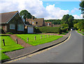
9
Deans Road, Alfriston
The South Downs Way passes through the village, and a marker post can be seen at the opposite corner.
Image: © David Purchase
Taken: 20 Oct 2014
0.09 miles