IMAGES TAKEN NEAR TO
Firle Grange, SEAFORD, BN25 2HD
Introduction
This page details the photographs taken nearby to Firle Grange, BN25 2HD by members of the Geograph project.
The Geograph project started in 2005 with the aim of publishing, organising and preserving representative images for every square kilometre of Great Britain, Ireland and the Isle of Man.

There are currently over 7.5m images from over14,400 individuals and you can help contribute to the project by visiting https://www.geograph.org.uk
Image Map
Images are licensed for reuse under creativecommons.org/licenses/by-sa/2.0
Notes
- Clicking on the map will re-center to the selected point.
- The higher the marker number, the further away the image location is from the centre of the postcode.
Image Listing (18 Images Found)
Images are licensed for reuse under creativecommons.org/licenses/by-sa/2.0
Image
Details
Distance
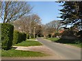
2
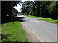
Firle Drive, Seaford, East Sussex
An unmade road. A footpath at the end leads to St Peter's Road and The Holt.
Image: © Kevin Gordon
Taken: 13 Apr 2008
0.09 miles
3
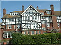
Bowden House School, Seaford
There were once 22 preparatory Schools in Seaford, now there is just one. Others have been converted or demolished. Bowden House is a residential school for the London Borough of Tower Hamlets.
Image: © Terry Jones
Taken: 11 Jun 2005
0.10 miles
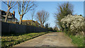
4
Firle Drive, Seaford
Path off Firle Road, Seaford
Image: © Paul Gillett
Taken: 10 Apr 2011
0.12 miles
5
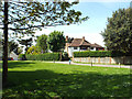
Open space and houses to the west of Firle Road, Seaford
Image: © Robin Stott
Taken: 4 May 2014
0.15 miles
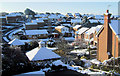
6
Beacon Drive from Katherine Way, Seaford
Image: © Kevin Gordon
Taken: 24 Jan 2007
0.15 miles
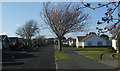
7
Alexandra Close, Seaford, East Sussex
With Beacon Drive running up the hill on the left.
Image: © Kevin Gordon
Taken: 9 Apr 2008
0.18 miles
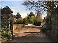
8
Lower Drive, Seaford, East Sussex
Lower Drive is named after Mark Antony LOWER (1813-1876) who was a school master and local historian. He lived in Seaford from 1867 and was responsible for establishing the Sussex Archaeological Society.
Image: © Kevin Gordon
Taken: 11 Apr 2008
0.19 miles
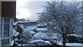
10
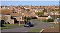
Valley Dip, Seaford
Beacon Road is in the foreground. Houses in Princess Drive, Alexandra Close, Katherine Way, Clementine Avenue and Isabel Close are also in shot.
Image: © Kevin Gordon
Taken: 3 Mar 2008
0.21 miles