
IMAGES TAKEN NEAR TO
Hodshrove Lane, BRIGHTON, BN2 4SE
Introduction
This page details the photographs taken nearby to Hodshrove Lane, BN2 4SE by members of the Geograph project.
The Geograph project started in 2005 with the aim of publishing, organising and preserving representative images for every square kilometre of Great Britain, Ireland and the Isle of Man.

There are currently over 7.5m images from over14,400 individuals and you can help contribute to the project by visiting https://www.geograph.org.uk
Image Map
Images are licensed for reuse under creativecommons.org/licenses/by-sa/2.0
Notes
- Clicking on the map will re-center to the selected point.
- The higher the marker number, the further away the image location is from the centre of the postcode.
Image Listing (21 Images Found)
Images are licensed for reuse under creativecommons.org/licenses/by-sa/2.0
Image
Details
Distance
1
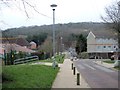
Hodshrove Lane, Moulsecoomb
Moulsecoomb Primary School is on the left
Image: © Paul Gillett
Taken: 27 Feb 2013
0.03 miles
2

Moulsecoomb Community Leisure Centre
Centre run by Freedom Leisure https://www.freedom-leisure.co.uk/centres/moulsecoomb-community-leisure-centre/
Image: © Paul Gillett
Taken: 3 May 2018
0.04 miles
3
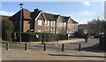
Moulsecoomb Primary School
Website: http://www.moulsecoomb.brighton-hove.sch.uk/
Image: © Paul Gillett
Taken: 27 Mar 2018
0.05 miles
4
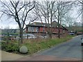
Moulsecoomb Health Centre
Provides clinics for the local community including district nursing, Smoking Cessation Clinics, Child psychology and counselling. Foot health, dental services and speech and language therapy, Enuretic Clinic. Community psychiatric nursing. Hearing aid supplies, contraceptive advice.
Image: © Paul Gillett
Taken: 27 Feb 2013
0.06 miles
5
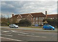
Moulsecoomb Primary School
Moulsecoomb Primary School was opened in 1929, and the Junior School in 1930
School website: http://www.moulsecoomb.brighton-hove.sch.uk/
Image: © Paul Gillett
Taken: 15 Apr 2012
0.06 miles
6
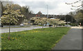
Cherry Blossom - Moulsecoomb
Attractive spring tree by the side of the A27.
Image: © Paul Gillett
Taken: 12 Apr 2019
0.09 miles
7
Moulsecoomb Way
Viewed from the A270 near the viaduct
Image: © Paul Gillett
Taken: 9 May 2009
0.10 miles
8
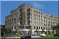
Hillfort House, Moulsecoomb Way, Moulsecoomb
Image: © PAUL FARMER
Taken: 6 Sep 2023
0.10 miles
9
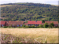
Moulsecoomb
Taken from the Downs looking west. Moulsecoomb was built in the 1930s to house those removed slum clearances within the city. Between the two houses in the middle the railway bridge over the A270 can be made out. Beyond that is Moulsecoomb Wild Park.
Image: © Simon Carey
Taken: 9 Oct 2005
0.10 miles
